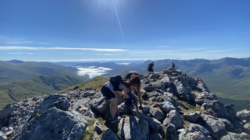
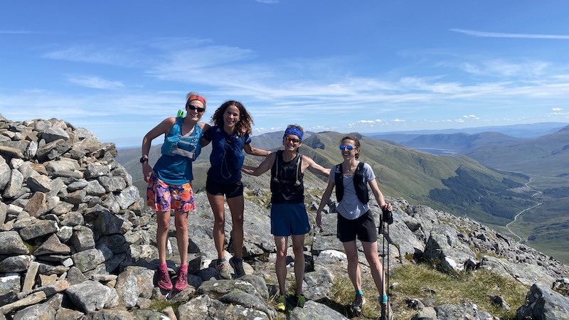
I am revisiting Munros and enjoying the opportunity to tackle a few “classic” routes. Last month, I did a run-hike of the South Glen Shiel Ridge in Kintail, north-west Scotland. Last weekend, I completed a route over six Munros – three on the Brothers Ridge and three as part of the Five Sisters of Kintail.
- Note: While there are five “sisters”, or five summits, only three are Munros.
The last time I did the Five Sisters walk was many, many years ago. It was the route that ignited a passion for bagging Munros. While on the walk I also met my now husband.
Then, in 2016, I walked the Brothers with my friend Rob.
It’s perfectly possible to link together the two routes because they are each an extension of the other, however it’s a big day out. On the day that I did the run-hike with friends, Rachel, Geraldine and David, it was very hot.

Planning: Brothers Ridge and Five Sisters
We decided to complete the route from east to west, using two vehicles. It is possible to tie in with a bus service on the A87. The fare for the short journey is around £9.
Having parked one car at the end of the Five Sisters ridge, we then journeyed back in the other vehicle to a layby just short of the Cluanie Inn. We set off on foot, along a short section of road, to the car park / cafe opposite the inn.

Annoyingly, the start of the route of the Brothers’ Munros has been obscured by a fence at the back of the car park. We had to exit the car park to one side, then traipse over boggy ground and grass to get to where we could easily see a trod heading uphill.


First, the three Brothers
The start of the run-hike was in low cloud but the day was forecast to be warm and sunny. As we climbed in a north-westerly direction, we moved between an obvious trod, then no trod, then a more obvious path again.
Our pace was dictated by the terrain and where there was a gentle slope, or a fairly flat gradient, we jogged. Then, when it became too steep, we walked briskly.
Very soon, the mist started to thin until we were above the clouds. The view back over our shoulders was a sea of fluffy clouds, while up ahead it was bright blue sky. It was Geraldine’s first experience of a temperature inversion and she was delighted.
From here, we simply kept running and walking upwards and upwards.
I confess that early on, I realised I was a great deal more tired than I had hoped I’d be. I decided it was simply one of those days when I felt fatigued. In addition, my friends are most likely fitter and faster than me! Whatever, the case, I wondered if I would end up managing the full route. It was a sobering thought because I normally feel a lot more energetic.


From a start elevation of 220m, we climbed some 750m almost entirely straight uphill to reach the first big summit at the eastern end of the ridge, Sgùrr an Fhuarail. However, this was not the first Munro, rather it was a high point at the end of the ridge, and we needed to descend a little before climbing again on an obvious path to finally arrive at Aonach Meadhoin at 1001m above sea level.


Sgùrr a Bhealaich Dheirg (1036m) was the next Munro, around 2km further west on the ridge. I felt like this Munro took a while to arrive and, after a fairly steep descent, we faced another climb. Thankfully, the stunning views were just rewards for our efforts. There were numerous mountains peaks and ranges of the west Highlands to enjoy, including, across the other side of the main road, the long South Glen Shiel Ridge with its seven Munros.
Again, I felt more physically tired than I had expected to and I was frustrated to find myself unable to keep up with my friends. All I could do was watch as they ran ahead, knowing that they would wait for me in due course.
After the second Munro, I suggested that I might drop back to the road at the end of the Brothers ridge. My friends said there would be no need for that but I was worried about the annoyance of holding them up.


Munro 3 of the Brothers Ridge
Munro three, Sàileag, was another two kilometres or so further west again. To qualify as a Munro, the summit should be at least 914m (3000ft) but I do wonder about the drop between Sgùrr a Bhealaich Dheirg and Sàileag.
It is usually assumed that there needs to be a summit prominence of at least 500ft (152m) to achieve Munro status but I question whether this is the case between these two Munros.
Anyway, we took the Munro list at its word and claimed our third Munro of the day, Sàileag, at 956m.

Brothers to the Sisters Munros
The route descends to around 725m at Bealach an Lapain, between the Brothers and the Sisters. It was at the bealach cairn that I spotted Hubby G for the first time some 13 or 14 years ago. We were both part of a group of walkers, although we weren’t aware at this point that we were in the same party. It’s a long story but suffice to say we became friends and then partners.
It was the first time I had returned to the spot and it was a little sad I was not accompanied by G. Next time we’ll go together I hope.


Five Sisters of Kintail
The four of us looked ahead, further west, to see a long line of summits spreading out on the “Five Sisters” ridge. Sgùrr Fhuaran, which is highest of the peaks, seemed a long way in the distance ahead
I had already decided that I would be continuing with the long route, despite being under par, and I was grateful that the others were being patient. They all insisted that the pace was good for a long and hot day in the mountains.
And so we began climbing again, up and up to reach Sgùrr nan Spainteach (the peak of the Spaniards) at around 990m. A descent to the next bealach was rocky with a short section of down scrambling (nothing too daunting!) and then a further climb.
It felt fantastic to reach Sgùrr na Ciste Duibhe at 1027m, our fourth Munro of the day and the first Munro of the Five Sisters. Knowing we were more than half way – although still with a decent amount of ascent and descent – lifted my spirits and gave me a small injection of badly needed energy.
My biggest worry from here was having enough water to drink. It was such a hot day and while I am usually a conservative drinker, on this run-hike I was very thirsty.
We continued the pattern of the day with another drop to a bealach and then a further climb.

It was funny because for almost the entire route, we been playing cat and mouse with a walker. Mateusz (spelling?) told us he was originally from Poland and now lived in Aberdeenshire. He is a keen Munro bagger. While we aimed to run some sections and then rest for a bit at summits to enjoy the views, Mateusz’s approach was to traverse at walking pace, but stop fewer times.
While we were quicker on the descents and flats, Mateusz then caught up with us at most of the summits. It was fun to exchange some chat with him.
The next Munro, Sgùrr na Càrnach felt tougher than any of the others. Of course, we were now tiring but the route was also rough and on stony and seemingly unrelentless zig-zagging path. Finally, we topped out at 1002m to claim Munro five.
The history books tell me that Sgùrr na Càrnach only gained its Munro status in 1997.
A equally stony and rough descent took us to Bealach na Càrnach, after which we faced the climb to Sgùrr Fhuaran at 1067m.
Thankfully, we spotted a pool of water and also a small flowing stream where we were able to collect much-needed drinking water. it was a huge relief to gulp the cool liquid.
My leg muscles were very fatigued and it felt like a long slog to finally bag the sixth and final Munro of our day.


… And still there was more ridge to come
Many walkers will head west off the ridge just past Sgùrr Fhuaran to complete the walk at Glen Shiel far below.
However, we could see there was more ridge – and some small summits – further ahead and we decided to continue. We talked about a plan to complete the five summits of the Five Sisters.
First, we descended westwards for some 300m (my head was already worrying about climbing up again!) before joining a path that cuts back towards a northerly ridge. More downhill took us to Bealach Buidhe and then more up.
We headed towards a high point, Sgùrr nan Saighead, which counts as the fourth of the Five Sisters, although not a Munro.
Further along the ridge, we descended to another bealach, ran over a small rise and headed towards a steep-sided summit called Beinn Bhuidhe. This is neither a Munro, nor one of the Five Sisters!
The fifth “Sister” is in fact further along the ridge to the north-east, after a descent to a bealach and another climb. However, we didn’t make it to Sgùrr na Moraich! Maybe our brains were befuddled due to fatigue and the heat, or perhaps there was a subconscious collective desire to head downhill to find a cooling river, who knows? In any case, it means we will need to return sometime to do it all again!
The river, Allt a Chruinn, that we did find far below the ridge was the most perfect and delightful place to cool our hot bodies and drink extra water.
The final section of around 3km was the most runnable of the entire route. A gentle descent on a narrow but well-trodden path on the northern bank of Allt a Chruinn provided an easy return to our vehicle at Allt a’chruinn village.
We then drove back along the glen to retrieve our other vehicle.
Despite my general fatigue all day, the run-hike of the six Munros of Brothers and Sisters ridges of Kintail had been superb.
There are many reasons why I celebrate our move to the Scottish Highlands including the amazing outdoors playground on our doorstep and making new friends who are always up for an adventure.


Route details: 6 Munros of Brothers and Sisters of Kintail
Distance: 21k.
Toal elevation: 2444m.
Useful kit for run-hike of Brothers and Sister ridge
Because it was a summer outing I took fewer cold and wet weather items than I would in the chillier months.
I used my Montane hydration pack (equally the Montane Gecko VP 5 would have been a good option).
I added a Montane Spine waterproof running jacket, a lightweight insulated jacket, an emergency bivvy bag, gloves, food and water.
I also used the Komperdell trail running self-deploying carbon poles.
It was a hot day and water was scarce until later on the ridge. Rachel had cleverly added water sterilising tablets to her pack. Equally, a water filter would have been a good idea.
We also has the route detailed on n OS Map app, as well as maps and a compass.
I recorded my route on the Garmin Endura sports watch.
