I am walking the Clyde Coastal Path in short stages. The Clyde Coastal Path (CCP) extends from Milngavie in East Dunbartonshire to Kelly Burn, between Wemyss Bay, in Renfrewshire, and Skelmorlie in North Ayrshire.
The route is around 55km / 35 miles in total and after a section inland and over low hills, it mainly hugs the coastline. There are a few alternative route options along the way.
The walking (and off-road cycling) route links the West Highland Way and the Ayrshire Coastal Path. It is also part of the International Appalachian Trail (Scotland) , which traverses the entire western coastline of Scotland from the Mull of Galloway to Cape Wrath.
It would be possible to walk the route in three main sections:
- Milngavie to the Erskine Bridge (14km)
- The Erskine Bridge to Greenock (23.7km)
- Greenock to Kelly burn (coastal route 20.6km or over moorland 17.8km).
I am walking the full route in sections of around 7km to 10km each and enjoying evening and afternoon strolls with my friend Ellen.
See Clyde Coastal Path: Stage one.
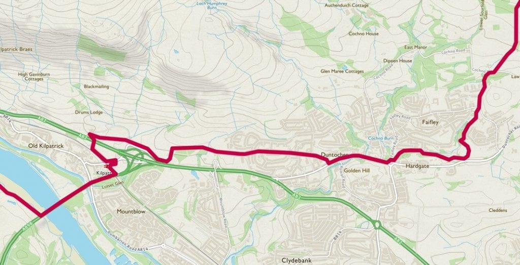
Clyde Coastal Path: Stage 2
We walked from Cochno Road, near Hardgate, to the south-western end of the Erskine Bridge at Boden Boo, a park and woodlands on the banks of the River Clyde.
Distance: 7km/ 4.3 miles
Elevation: An overall descent of around 120m.
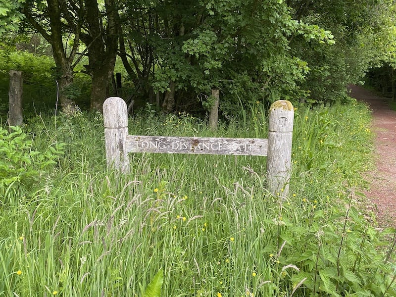
The walk starts at Cochno Road with obviously signposting showing the way along a path through woodlands. It feels promisingly rural for a while before you then walk into the streets of Faifley, Hardgate and Duntocher.
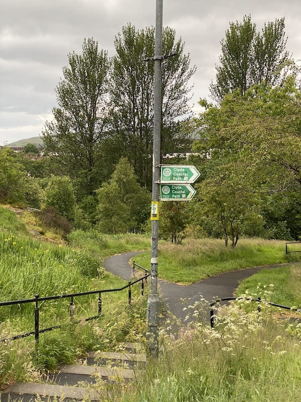
Watch out for signposts that could easily mislead, especially those that seem to be pointing in exactly the wrong direction. In some cases, the signs look like they need a bit of attention to ensure they point the right way.
Staying as far as possible away from pavements along the main roads, the route winds through quieter streets. It would be misleading you if I said this is a picturesque part of the route. Rather, it was interesting because it heads through streets I have never been along before.
There are also a few bits and pieces of unusual architecture, such as a Duntocher Trinity Church of Scotland. The church was rebuilt in 1952 after being destroyed during the Clydebank Blitz.
If you prefer to be surrounded by countryside this part of the Clyde Coastal Path is best avoided. Ellen and I decided we liked the mix of rural and urban on this stage.
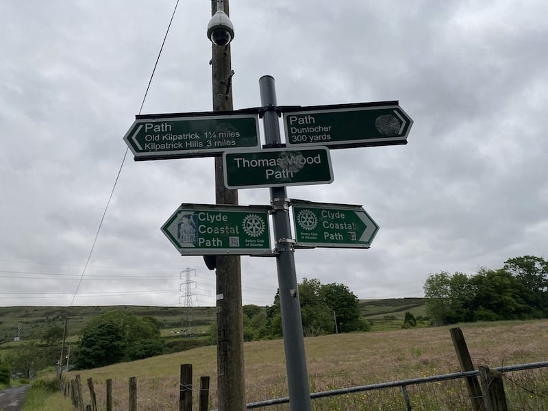
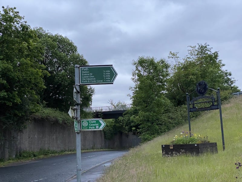
West of Duntocher, the route reaches more open countryside again as you head towards Old Kilpatrick. There are signs to show you are walking the Thomas Wood Path. The path is 300m long and was named to commemorate a local man who helped supervise its construction.
It was opened in May 2012 and runs parallel to the line of the Antonine Wall and is part of the Clyde Coastal Path.
Look up to your right and you’ll enjoy lovely views of the Kilpatrick Braes. I have had many great runs in these hills. Look left and the land descends towards the River Clyde.
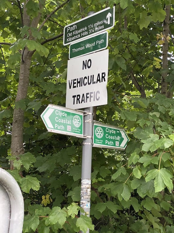
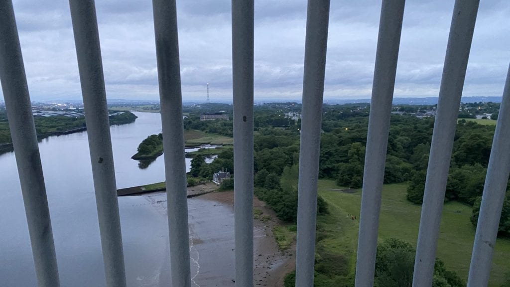
Clyde Coastal Path signs further on show you the way to access the path over the Erskine Bridge. The bridge crosses high over the River Clyde and the views through the railings are stunning or scary, depending on your feelings about being up high!
The railings have been built up in recent years as a way to try to prevent suicides. Sadly, the bridge has historically been a location for people taking their own lives.
Again, while the route runs alongside main roads and is quite noisy in places due to traffic, it still offers the attractions of great views and an interesting juxtaposition of urban and rural.
The end of this stage is in Boden Boo park. We start here for stage 3.
See the Clyde Coastal Path route. You can download a GPX if you have a subscription to OS Maps.
See Clyde Coastal Path: Stage one.