This route of 31km with 1900m of ascent starts and finishes at the Sugar Bowl car park on the road to Cairngorm ski centre, near Aviemore in the Scottish Highlands. It heads to three high Munros, Cairn Toul, Sgor an Lochain Uaine (also known as Angel’s Peak) and Braeriach.
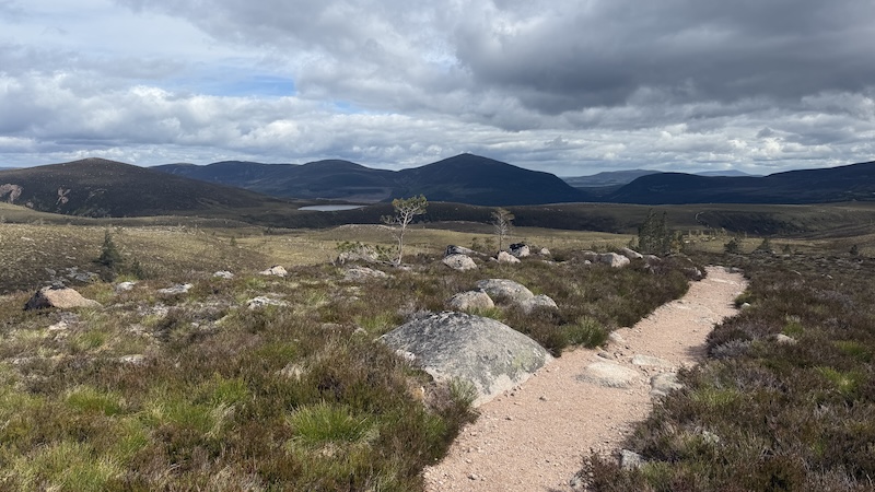
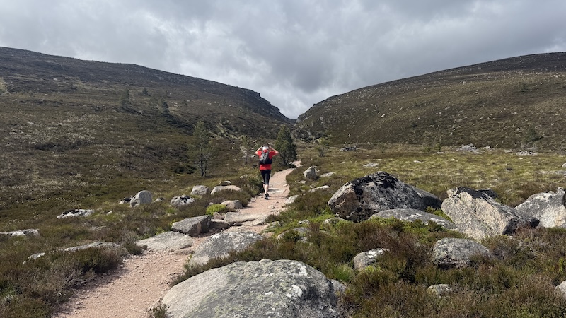
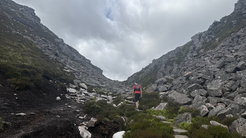
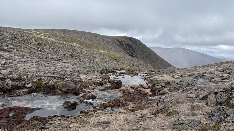
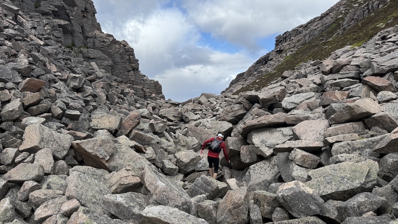
The adventure takes advantage of a well-laid path south-west, via a rocky, boulder strewn geological feature known as the Chalamain Gap and then on to the mountain pass called the Lairig Ghru.
The pass rises to a high point of around 840m and, along with my friend David, I ran to this point, then descended to 580m. After some 12km a of running, we looked up at eastern slope of .Cairn Toul.
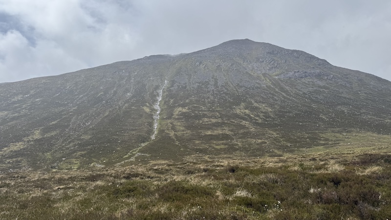
I have previously reached Cairn Toul as part of a run-hike of five of Scotland’s tallest mountains, but I had never climbed up this side of the mountain.
The mountain slope is steep, rugged, covered in thick vegetation and unrelenting with a boulder field at the top to negotiate. But the route was quite speedy and very direct.
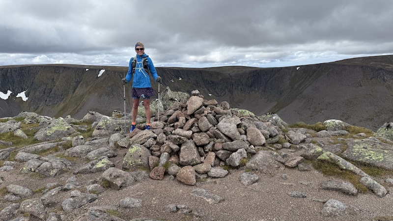
David and I topped out on the summit of Cairn Toul at 1291m after 15km.
Two more Munros: Angel’s Peak and Braeriach
From Cairn Toul we headed west along the ridge and with surprising speed we reached Sgor an Lochain Uaine (Angel’s Peak) at 1258m. Apparently, one source reveals it’s called Angel’s Peak because in certain light, the ridges either side of the summit resemble an angel’s wings.
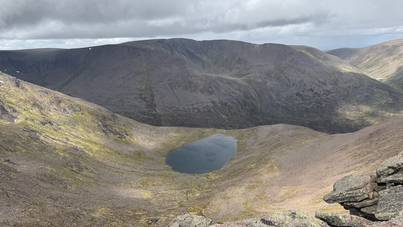
The third Munro, Braeriach, took comparably much longer to reach. We wound north around the top of several deep corries and passed the Falls of Dee – a high waterfall on Braeriach – before ascending above Corrie Bhrochain to reach Braeriach summit at 1296m.
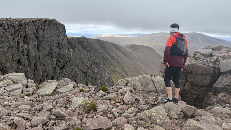
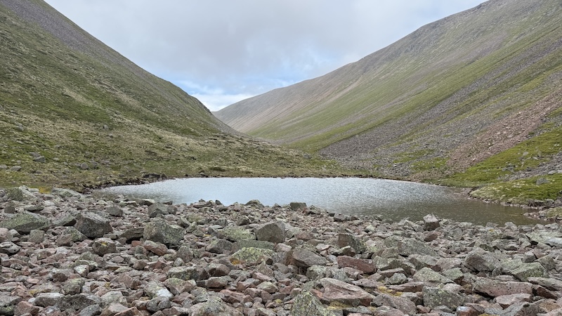
There were plenty of trods to pick up along the ridge, although because it was fine weather , we could also see where we needed to go. In poor weather, a map and compass would be essential to avoid the edge of the ridge.
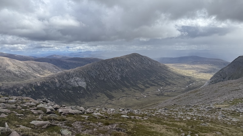
Our descent route headed east and then north. Again, there was a fairly obvious path and we run or jogged making sure to look where we were going. The path is littered with stones and rocks and we needed to be careful not to trip.
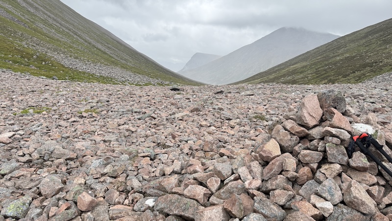
The descent was fairly gentle, before steepening back towards the route of the Lairig Ghru. We crossed over the pass path and tracked back on to our outward route that would take us back through the Chalamain Gap. We needed to ascend again, which felt hard on tired legs, then climb over the rocks and rejoin the path on the other side.
There were some further minor ups and downs but it was mostly a descent route until the final couple of hundred metres. You need to ascend a steep section after crossing a bridge to return to the Sugar Bowl car park.
This is a great route with mostly well-trodden paths or trods (apart from the climb up the side of Cairn Toul). As an alternative, you could run or hike further along the Lairig Ghru to reach Corrour Bothy and then find a much more obvious and well-trodden path up Coire Odhar to gain the high ridge, then head north to Cairn Toul summit. It would add distance but might well make for an easier ascent compared to our steep and direct climb.
Route details: Cairn Toul, Sgor an Lochain Uaine and Braeriach from Sugar Bowl car park
Distance: 31km
Total ascent: 1900m