A 16km walk along the beautiful Black Isle coast takes you from the village of Rosemarkie to Cromarty. The total ascent is only around 200m and most of this is done at once when the route climbs steeply through forestry at Eathie. I walked the route with my friend Elizabeth and after lunch in a cafe at Cromarty, we caught the bus back to Rosemarkie.
Note: The walk can only be completed at low tide. Check UK tides for Rosemarkie.
Rosemarkie to Eathie Fishing Station
We parked at the free public car park in Rosemarkie, just off the main road. From there, it was a short walk east along a one-way street to reach the coast. Look to your right and there is a huge sandy beach that leads to Chanonry Point, a spit of land famous for being able to see a pod of bottlenose dolphins. By the way, the best time to see the dolphins from the land is on a rising tide, an hour or more after low tide.
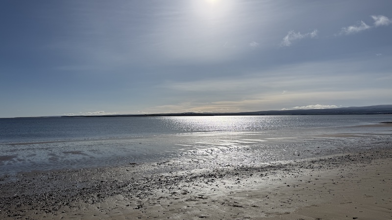
Instead of heading to Chanonry, Elizabeth and I turned left to walk on to the beach north-east of Rosemarkie. The shoreline is a mix of sand, rocks and pebbles with sections of rocks that require a some careful clambering in places.
The views are beautiful with wide sweeping sea vistas over the Moray Firth and the wider sea to the right. For the first four or five kilometres, we could see the shore of Moray across the water.
This is a route to do on a fine day because the sea glimmers and glitters beneath a blue and sunny sky.
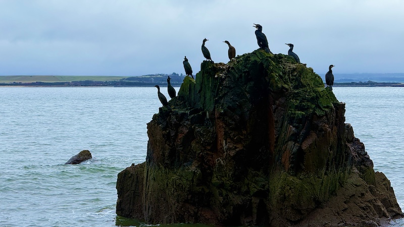
All along the Black Isle coast, large rocks and small stacks jut out above the sea and many offer a resting place for birds, such as shag, razorbill, guillemot and cormorant.
To the left are high cliffs that feature a network of natural caves. If you have the time, it’s worth exploring the caves but you will need a head torch or similar for some of the longer caves.
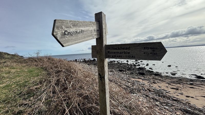
If you prefer a shorter circuit walk, you can return to Rosemarkie on foot by taking a path up through cliffs below Brown Hill. Thee are wooden waymarkers at the top of the beach.
Instead, Elizabeth and I continued towards Cromarty.
Closer to Eathie, look out for fossils along the beach. The Eathie sediments contain many fossils, including bivalves, ammonites and belemnites.
At around 8km, look for an area of trees and, on the beach, a stone building, connected to Eathie Fishing Station, which served as the seasonal home of a fishing team each year. Until the mid-1980s, from February to August, salmon were caught at low tide in large nets string out into the sea.
Eathie beach to Cromarty
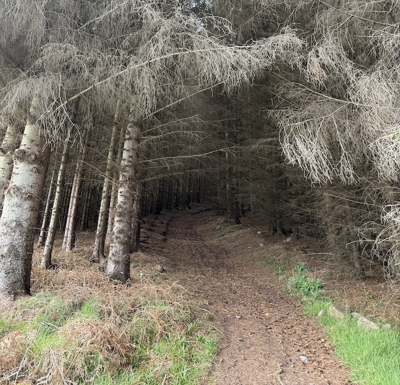
In front of the building are wooden signs that show the way uphill, zigzagging to lessen the steepness of the slope. The path leads to a wide avenue through tall trees. Follow this route until you reach a minor road.
A car park by the minor road has an information board about the pioneering Scottish geologist Hugh Miller, who was born in Cromarty in the early 1800s. He is acclaimed for a collection of fascinating fossils. More about his life and work can be found at Hugh Miller’s Birthplace Cottage and Museum in Cromarty.
Turn right out of the car park and walk along the road for around 2km before turning right on to a track through fields. This takes walkers past a row of homes, including Mains Farm, where you then turn left and go downhill to Cromarty itself.
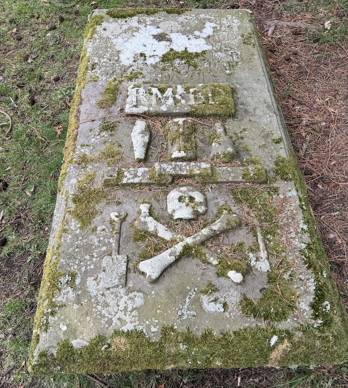
We popped into an old cemetery before reaching the village itself, where they are many very old graves. Some had skull and crossbone markings on them. They don not signify buired pirates (!) but rather they are a symbol that translates to “remember you must die”. It serves as a stark reminder of mortality, the fragility of life, and the inevitability of death.
Elizabeth and I then walking into Cromarty and enjoyed a spot of lunch at the Last Splash cafe before catching a public bus back to Rosemarkie. No26 or No26A.