Staying local during lockdown provided the opportunity to discover a wealth of great mountain biking routes on my doorstep in East Dunbartonshire. This article was published in The Scots Magazine. If you enjoyed reading this article, why not buy another Scots Magazine, or a subscription.
A chance to explore locally by mountain bike
For years I’d seen the signposts for the Clyde Coastal Path (CCP) dotted around my community, yet I’d never followed them.
Like many people I would stick to more familiar local routes, such as the West Highland Way (WHW) and John Muir Way (JMW), and save my exploring on foot or by bike for places further afield at weekends.
Then came Covid-19 lockdown and the same-old trails lost their appeal after riding them repeatedly – and more people crowded many destinations.
I was craving a a new adventure – and suddenly the green signs for the Clyde seemed to promise just this.

Four reservoirs MTB route
With tight restrictions on where we could go – this was Lockdown One – I sat down with a map and scoped the countryside on my East Dunbartonshire doorstep.
My plan was to challenge myself to find new and different routes for a series of day mountain bike rides, each starting and finishing at my Bearsden home.
With a week of sunshine forecast, I set out for the first ride, riding the Clyde Coastal Path to the Kilpatrick Hills.
Cycling at first through pretty woodland at the edge of a housing estate in nearby Milngavie, I’m amazed I’ve never seen the path before.
After crossing a (familiar) main road, the CCP climbs on an (unfamiliar) trail beside a burn, through fields and on to a track to reach a height of 750ft.
The views are suddenly expansive and sweep from hills to coast and over urban Greater Glasgow. I have never been to this spot, despite it being only five miles from home.
Pedalling a mountain bike on rough terrain is more tiring than road cycling and according to my planning I still have 20 miles to go and 1700ft more ascent.


A short descent leads to Douglas Muir quarry, eerily silent due to lockdown. An information board states an older section of the quarry has been returned to moorland and wetland, which are now home to wildlife.
More descending on peaceful singletrack brings me to a stretch of road, which is again familiar as access to one of my local hill runs.
Here, I leave the CCP, which continues west, to join a short section of tarmac before veering off on to a new-to-me track that climbs north amid farmland.
I’ve met only three other people so far – and, thankfully, no one is around to watch me slog slowly up a steep hill.
At the brow, I follow a sign to Jaw Reservoir, riding a narrow path between two fenced fields. In one field, a trig pillar sits at a height of 229m (751ft).
A trig always calls for a photo and I admire the vista of rolling green countryside giving way to the clutter of city buildings.
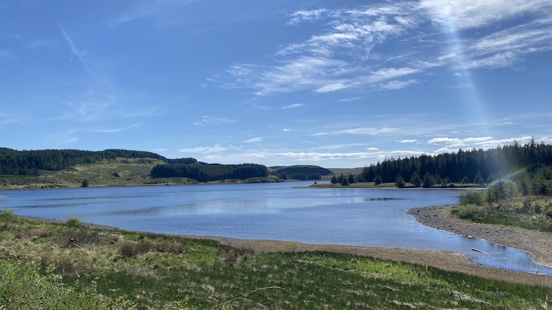
Climbing further, on track and cropped grass, the waters of Jaw suddenly pop into view.

New places, but still so local
Again, this is a place I’ve visited before but never have I crossed a dam at the southern end.
A rugged path veers upwards from the shore of the reservoir, where I see a causeway I hope will take me north.
On the map, there wasn’t an obvious path on the northern side of Jaw but I decide to investigate.
A short hike-a-bike down a bracken-thick bank is required to reach the boggy shoreline of Jaw, then I jump into the saddle for a lovely ride on two flat and narrow grass-topped causeways that cross the waterway via a tiny island.
Closer inspection of the map reveals the causeways divide Jaw and Cochno reservoirs.
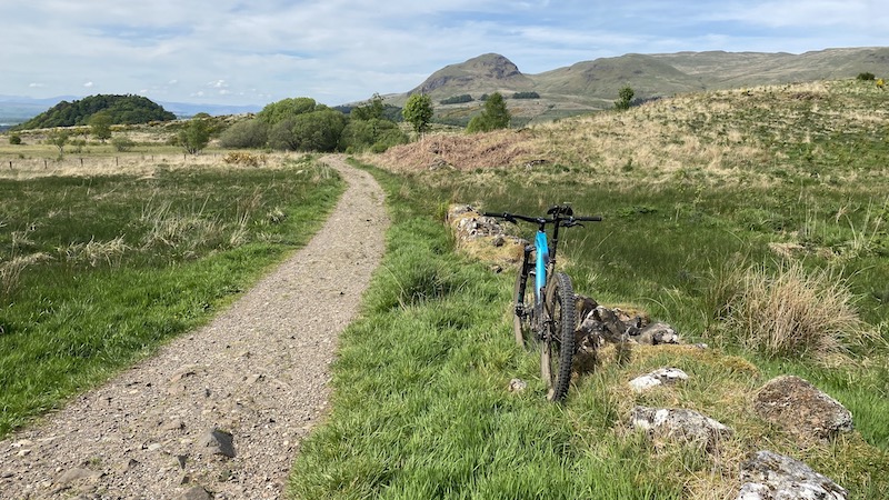
I’m delighted to find a narrow path that wiggles along the edge of forestry to join a well-made gravel track.
Climbing northwards, I ride to the highest point of the day at 1050ft, and just as I’m beginning to question my whereabouts, I turn a corner and see another expanse of water.
I recognise the triangular shape of Kilmannan Reservoir and then a smart wooden sign for the John Muir Way

Joining the John Muir Way.
The JMW, which was opened in 2014, cuts through East Dunbartonshire on its journey from Scotland’s west to east coast.
I can either head directly downhill or ride around another reservoir, Burncrooks. The weather is still warm and I set off on the three-mile rollercoaster-style loop.
The picturesque reservoir high in the Kilpatricks gives panoramic views of tantalisingly close mountains.
In lockdown, I can only dream of climbing to iconic summits such as Ben Lomond, yet I feel blessed to be able to see them.
The route home is deliciously downhill, firstly on the JMW and then on to the WHW. While it is easy to speed along, I relish the opportunity afforded by a reduced workload and sublime conditions to stop to look, lie in blankets of sweet-smelling bluebells and learn about local history from a series of art installations.
I call my adventure ride the “Four Reservoirs Route”.


The MTB route of two Ways
The following day, I feel a hankering to ride even closer to the mountains and planned a 35-mile circuit north, joining together the WHW and the JMW.
More sunshine and “taking my time” give rise to an adventure that while tiring due to the greater mileage and total ascent of 2700ft, is wonderfully diverse on paths, tracks and tarmac.
I pass Kilmannan and Burncrooks reservoirs again before entering a wild-feeling forest on a seemingly endless descent to the village of Croftamie at the edge of Loch Lomond & the Trossachs National Park.
The vista of mountains that I craved is rewarded time and again.
A section of the route follows a dismantled railway and the thrills of a high, narrow metal bridge over Endrick Water.
On a southern section of the WHW, I ride along the eastern edge of the prominent Campsie Fells before heading on to a network of paths in Mugdock Country Park and home again on roads and trail I know very well.


MTB ride to the Auld Wives Lifts
The final in the trio of big bike adventured visits an ancient landmark I’d long heard about but never found the time to locate.
Joined this time by my husband Gordon, who is sure he remembers going to the “Auld Wives Lifts” as a teenager, we map another loop of 20 miles.
Again, we leave our home and follow some familiar trails, including the WHW, as well as less used routes, such as the Strathkelvin Railway Path to reach sprawling Lennox Forest, above Lennoxtown.
Making up a route as we ride, but generally travelling through the forest north to south we chance upon another trig pillar with fantastic hill views and then cycle on to a quiet country road near tiny Baldernock.
Leaving our bikes at the roadside, we walk up to Craigmaddie Muir where, in a natural amphitheatre, a pair of large boulders with a third balanced on top are sited.
The Auld Wives Lifts are covered in carvings from hundreds of years, including Celtic heads, dates and inscriptions.
According to legend, the Auld Wives Lifts were named after three old women, having laid a wager which of them would carry the greatest burthen, brought in their aprons the three stones and laid them in position.
Truly, we remark, we would never have visited this fascinating spot if it had not been for lockdown.
Nor would we have lingered, hunting out another trig pillar and lying in the sun to take in impressive views of city and countryside before riding home with fresh discoveries and new views expanding our minds.

Kit list
- Mountain or gravel bike
- Comfortable cycling clothing
- Helmet
- Map and compass
- Mobile phone
- Water and food
- Puncture repair kit
- Spare inner tube
- Bike pump


