A weekend trip to the north-west of Scotland staying with friends at Hostelling Scotland’s Gairloch Sands Youth Hostel and a window of great weather gave me the opportunity to bag a new Corbett. Sail Mhòr can be most easily walked from Ardessie on the A832 between Badcaul and Dundonnell.
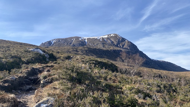
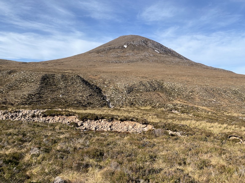
Sail Mhòr is at the end of the An Teallach range of mountains, yet it offers a much less daunting walk than the An Teallach traverse itself. Sail Mhòr rises to 767m, which qualifies it as one of the 222 Corbetts in Scotland. It was my 78th Corbett.
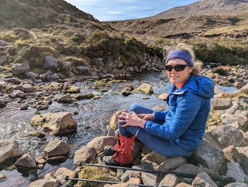
I enjoyed the 12km out-and-back route with Ben, who often joins me on the Corbetts. We set a relaxed pace in sunny and often warm weather.
The day before Ben had completed the two Beinn Alligin Munros of Sgùrr Mòr and Tom na Gruagaich with Hubby G and other friends, Stew and Tony. Meanwhile, I had slightly jaded legs after an evening run of 14km with my friend Lynsey to Rubha Réidh and Camas Mòr, near Melvaig.
Sail Mhòr walk: A burn, waterfalls and amazing views
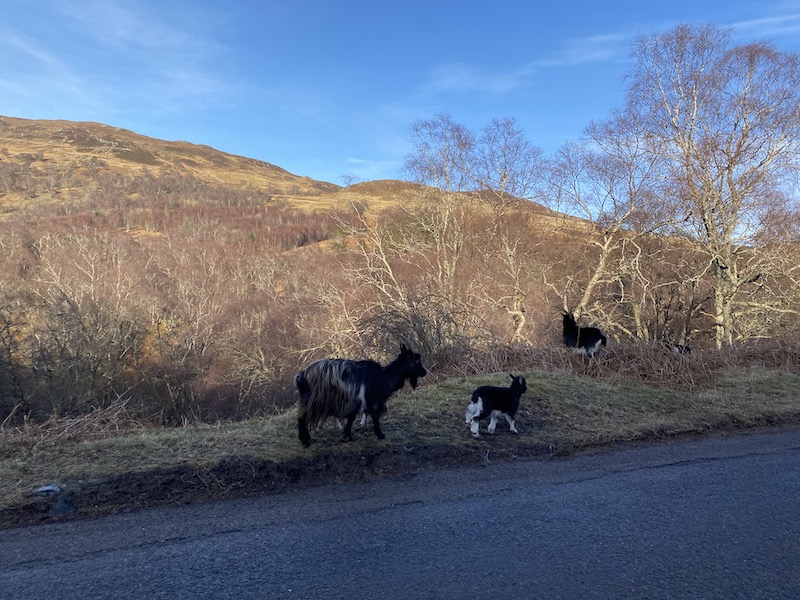
After parking in a road-side lay-by, you need to walk along the verge on the A832 to reach the path that heads up the side of a tumbling river. A herd of wild goats offered entertainment as they walked and ate their way along the road-side.
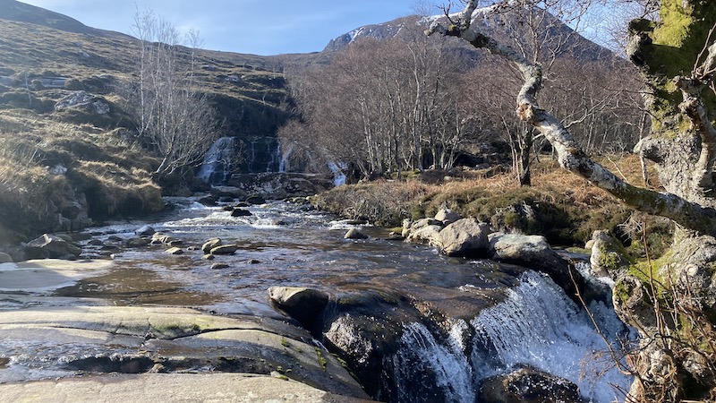
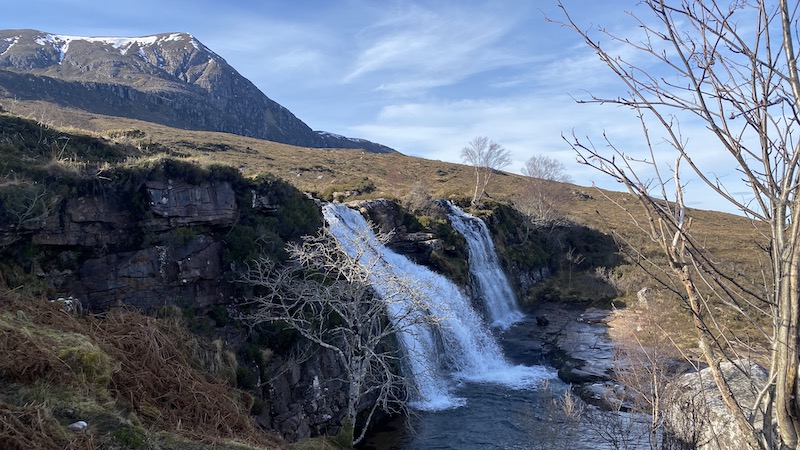
Keeping Ardessie Burn on our right, we started the climb on a boggy path. It’s a fairly steep climb to start with and we had over-estimated our clothing layers. We stopped every so often to take off a layer, gloves or a hat and to enjoy views of several beautiful waterfalls.
The route became rougher and the path comes and goes but it’s fairly obvious where to go as we aimed for a point higher up the burn. There are sections of the bank that have been affected by small landslides but trods take you zig-zagging up these and along the tops.
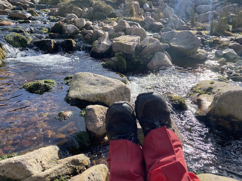
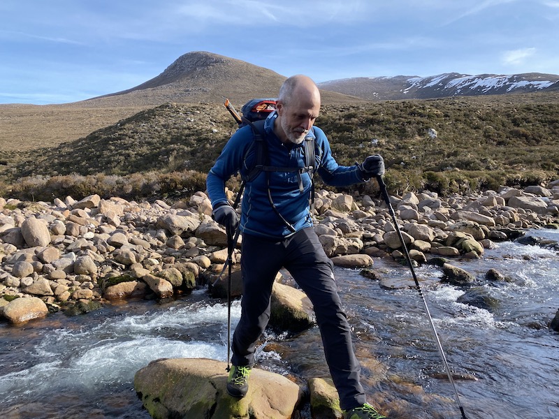
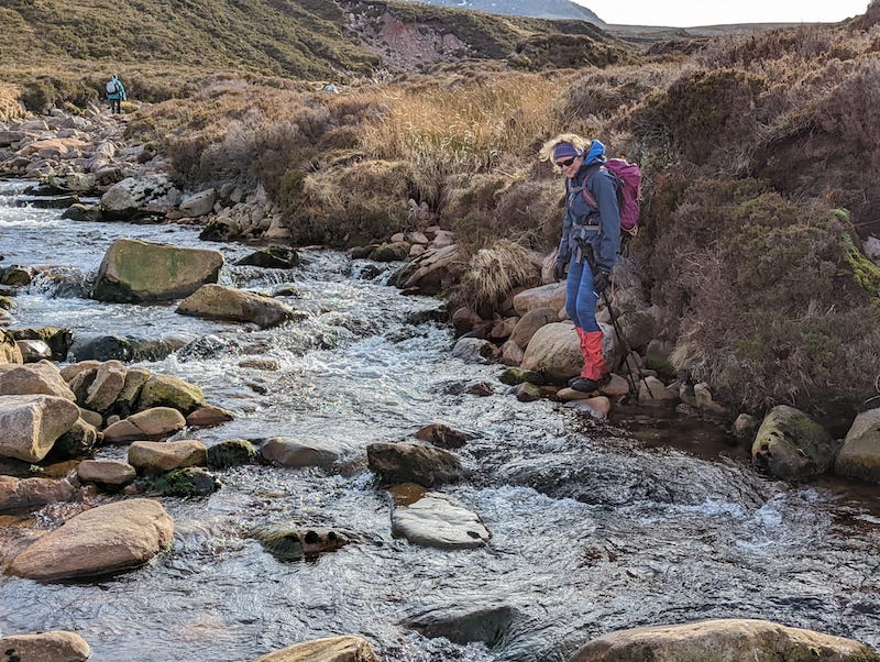
In spate, the burn could be tricky to cross but we managed to find a place higher up where there were enough large stepping stones to keep our feet dry. In fact, we needed to cross three waterways: Two where the burn runs south to north and another small burn to the west.
Rough moorland and a stony ridge
We stuck to the northern side of this burn as we progressed over more moorland. In summer, it might well take more effort to cross the moorland through long grass and deep heather but thankfully the vegetation was still in the early stages of spring growth.
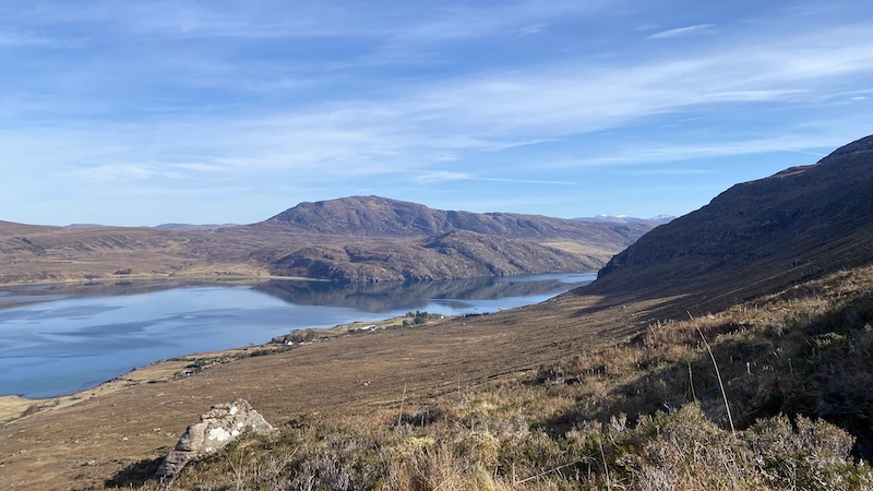
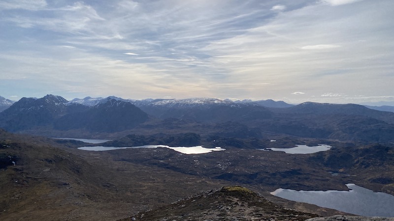
We continued west, aiming for a high bealach between Ruigh Meallain to the south and Sail Mhòr. This hike over rather featureless moorland might be rather bland if it was not for the superb views of surrounding mountains.
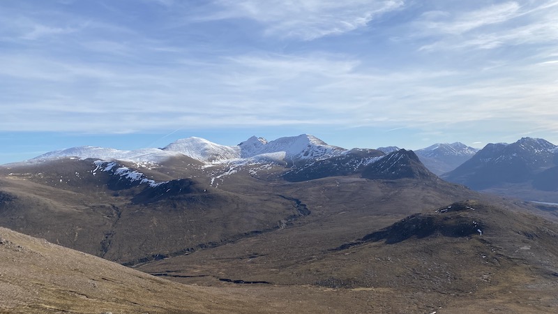
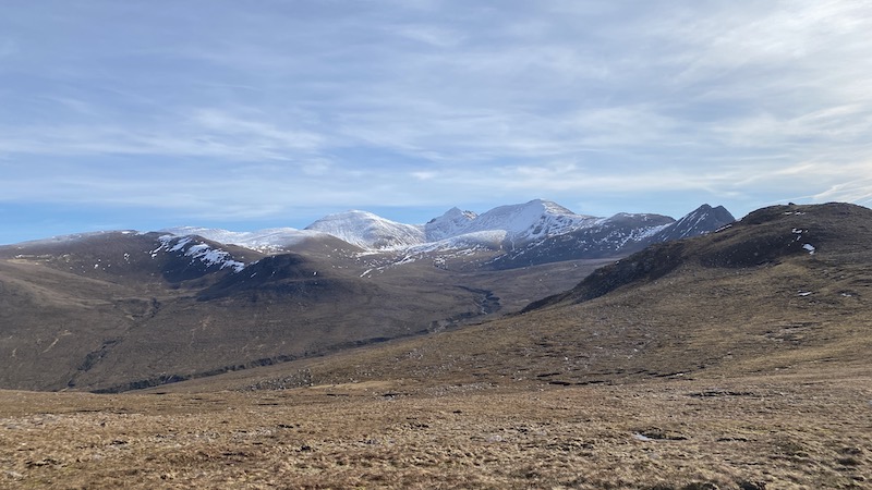
For much of the walk we enjoyed amazing views, including the An Teallach range to the south-east, as well as the mountains of the Fishefield Forest.
I told Ben about how fearful I was on An Teallach when I walked it more than a decade before with Hubby G. Back then I had little experience of Munro bagging and I thought the traverse was tough and exposed. I wonder how I would find it these days?
Ben and I walked south to north on the southern ridge of Sail Mhòr. It was steeper with lots of exposed sandstone but this meant we quickly gained height. There was a faint path to follow and as we climbed the views over the wider landscape and out to the coast grew ever larger and more breath-taking.
This is truly a magnificent place to walk and I recommend you save it for a clear and sunny day.
It was also breezy on this ridge and the higher we ascended the colder it became. We quickly headed to the first cairn – the highest – and then to a larger cairn that offered some shelter from the wind.
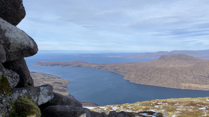
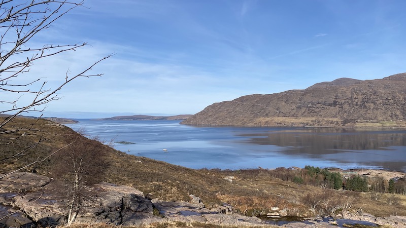
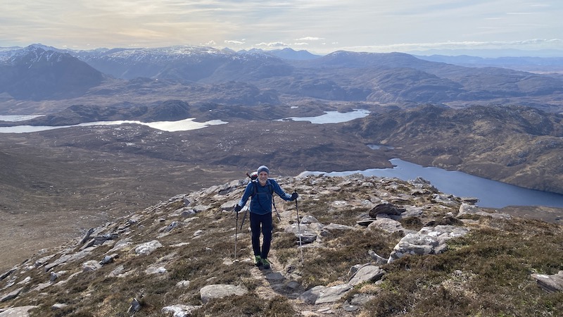
The steep northern slopes below us offered more fabulous panoramic views over Little Loch Broom, across a peninsula and to the coastal town of Ullapool. We could also see the Summer Isles just off the coast. If it were not for a strong and cold wind, we would have sat for much longer drinking in the vista.
Instead, we turned back the way we had come to find shelter to the south. The return route was similar to the way to came. The river crossing seemed tricker on the return and I needed to walk further upstream to find the right rocks to use to cross from bank to bank.
The path also seemed boggier and more slippery on the return route and I almost ended up on the ground a couple of times. I think perhaps I was quite tired after a weekend of fun and adventure with friends at Gairloch.
The waterfalls somehow seemed more impressive later in the day. It may have been the afternoon light or perhaps we were on a path that came closer to the cascading burn. The views over the west coast were also a further treat. The sea looked calm and the blue-turquoise waters were fabulous.
As I have said further up, you should reserve this Corbett walk for a fine day because the views are amazing.
Our route on Strava and OS Maps.
Corbetts bagged: 78