There are days when I am energetic and other times when I feel like I have a flat battery. On Saturday, even as I started the adventure to reach two remote Corbetts, Beinn Lair and Beinn Airigh Charr – plus a Fiona Meall Mheinnidh – from Poolewe with my friend David P, I lacked my usual oomph. I hoped that I would regain my usual verve at some point but, as it turned out, I didn’t and I needed to make a plan B.
Plan A: Beinn Lair, Meall Mheinnidh and Beinn Airigh Charr from Poolewe
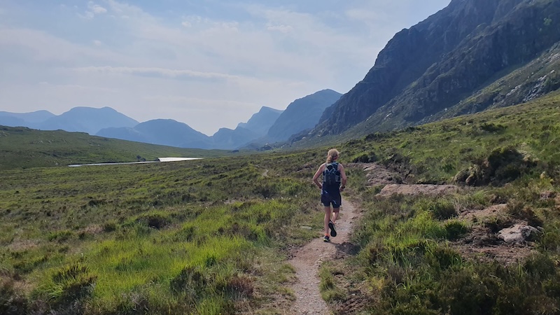
These mountains are remote and located in a wild and rugged landscape amid the Letterewe and Fisherfield forests. David and I decided to cycle the first 9km to 10km of the route and we wisely chose mountain bikes. A gravel bike would also be possible if you are more skilled than I am on rough terrain.
The cycle route heads south-east from a car park in Poolewe village and, at first, on a tarmac road. We then progressed on to a good track, before turning off on to a rougher track that narrows to a path through a forest. There is one section of purpose-built path in the forest but the rest is quite rough and can be boggy after wet weather.
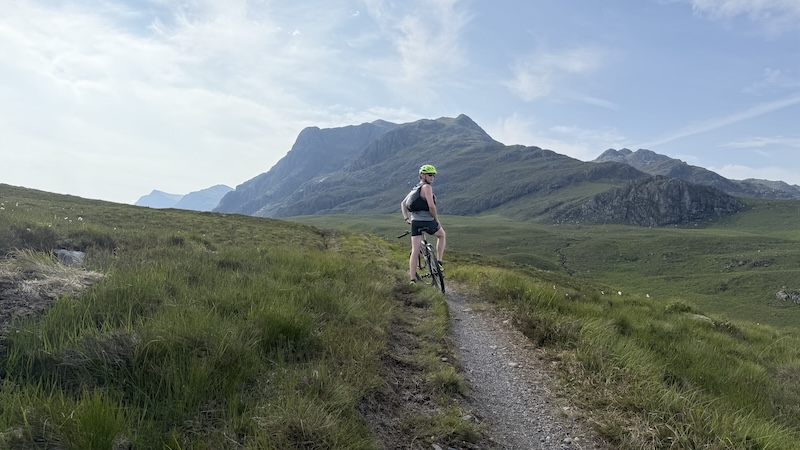
After the forest, we passed through a gate in a fence and on to wilder moorland. The path continues as a rutted singletrack line but it’s still rideable. The bike route undulates with a few short, steeper sections but generally it climbs relatively gently from sea level to 300m elevation.
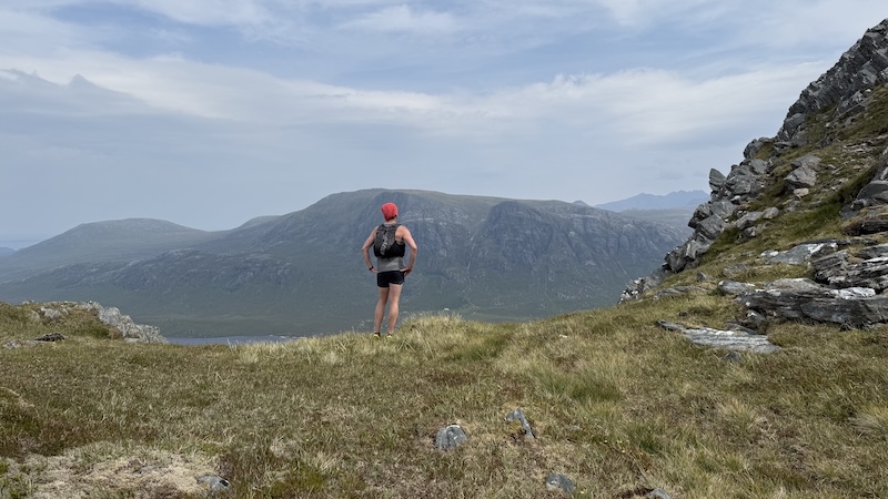
As we progressed along the glen, our mountains loomed larger and dramatically ahead to our right.
We left our bikes at a high point in the glen and then continued on foot. It is easily possible to continue on two wheels along the glen if you want to, but our plan was to descend Beinn Airigh Charr after Beinn Lair and Meall Mheinnidh to regain our bikes.
Run-hike of Beinn Lair
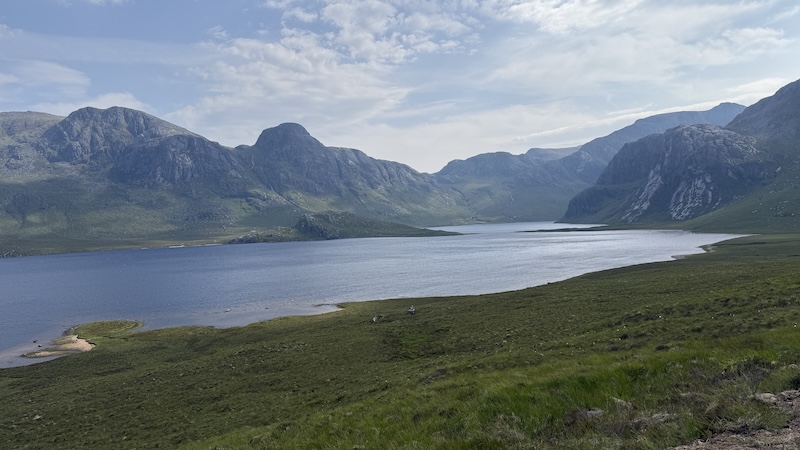
We continued south-east along the glen on foot. It’s a great path to run (or hike) with a few undulations and a slight overall drop in height. Almost at the end of Fionn Loch, we took an obvious path uphill and more directly south.
This is where the climb proper started and as David ran and walked strongly uphill, I realised any hope of a sudden energy boost was unlikely. My legs were fatigued and my breathing was laboured. It was early on the day, but already the glen was warm and I blamed the heat. I also thought back over my week of exercise and realised it had been quite leg heavy.
I decided that if I felt no better on the summit of Beinn Lair, I would urge David to go on ahead to complete Plan A, while I would make another plan to do the first Corbett and the Fiona but then head straight back to the glen.
In any case, I had previously summited Beinn Airigh Charr on another bike-and-hike adventure so the Plan B made good sense.
I know David would have been happy to go at my slower pace – as friends, we look after each other – but I was also aware that he had not bagged Beinn Airigh Charr and if I decided to go with him, we would take a lot longer. In addition, I had a time constraint and needed to be home in time for a family evening get-together.
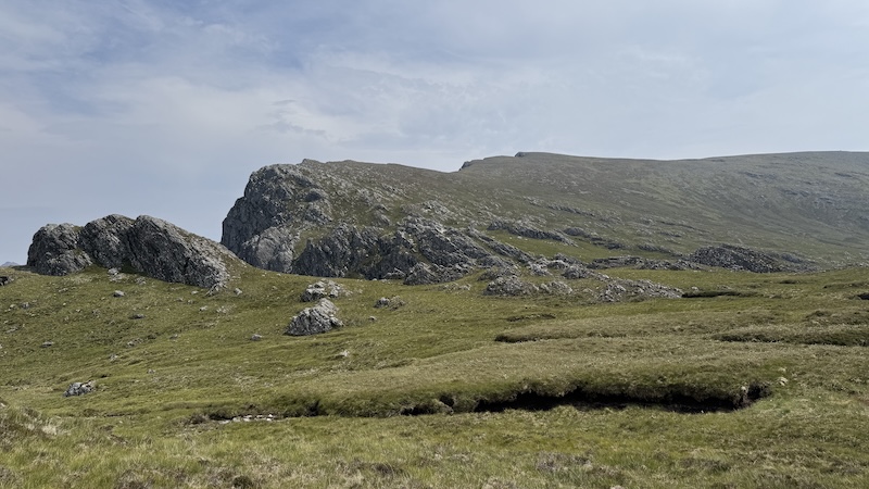
The path climbs up the south-western flank of Beinn Lair to a bealach at around 460m, before another path/trod tracks east. David and I headed for the top of the ridge – the land drops steeply to the north – and continued on a decent trod.
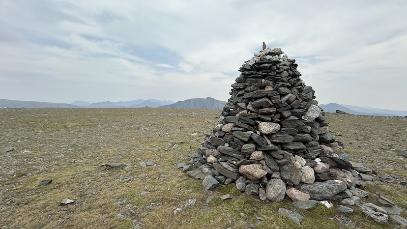
There is a cairn at around 825m but the summit of Beinn Lair is almost another 1km further south-east at a height of 858m. The top has a huge cairn!
It was here that I told David of my Plan B and while he could see I was disappointed, he agreed it was my decision. We had a look at the map together and I thought it would be reasonable to descend from the next mountain, Meall Mheinnidh, back to regain the track along the glen.
Beinn Lair to Meall Mheinnidh
I watched as David set off at a good running pace. Meanwhile, I took my time, descending Beinn Lair further away from the ridge, running and walking over quite rough terrain. Lower down, I tracked above the crags and then followed a path to descend. In retrospect, I should have followed the same route as for the ascent but I didn’t keep my eye on the map at this point.
This meant I ended up descending further than I needed to, on to the previously well-defined path, and then I had to reascend to a higher point on the bealach again.
Back on the path, I ran south again and uphill before starting my climb on the Fiona, Meall Mheinnidh. A vague trod came and went but, mainly, I navigated over rough terrain in a north-westerly direction.
My aim was to avoid the rocks and crags to my north but also make as straight a line as possible for the summit at 722m. I needed to ascend a total of 200m and while I was sure I was meandering around too much, whenI now look at the map I actually kept a fair straight line and avoid the worst of the crags.
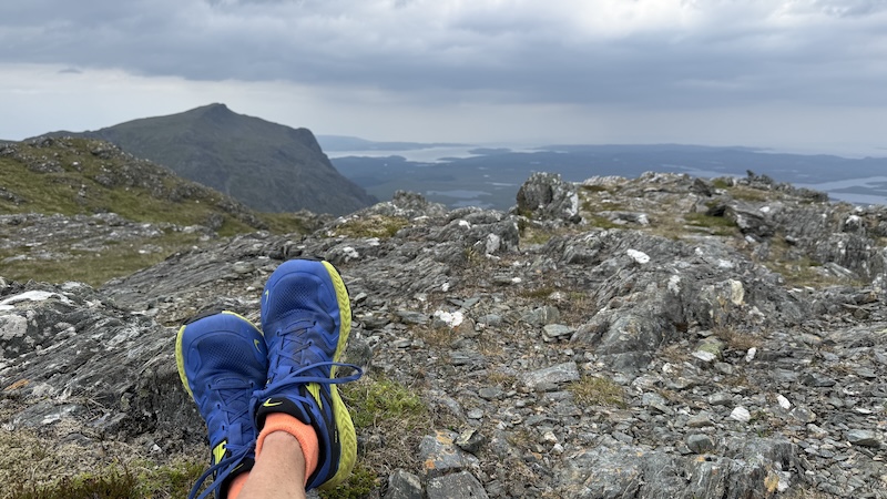
The summit was an excellent viewpoint, taking in the magnificent ridge to Beinn Lair in the east and also the rugged outline of Beinn Airigh Charr to the west. Across the glen, more peaks formed a superb vista to the north.
I stopped for a sandwich on the summit of the Fiona and consulted the map. I was aware that the north-eastern side of the Fiona was a steep drop and I was keen to avoid these crags. I could also see that the ground was rocky to the west and south but I was fairly sure I could find a way to descend.
It is much harder to descend rocks and crags than it is to ascend because you can’t always see how the ground will fall away. I spent a frustrating half hour or so trying to weave a route through the crags and eventually traversed on to kinder and gentler terrain.
Looking back, it would have been better to return in a more southerly direction and then contour north-west around the base of the mountain at an elevation of some 500m.
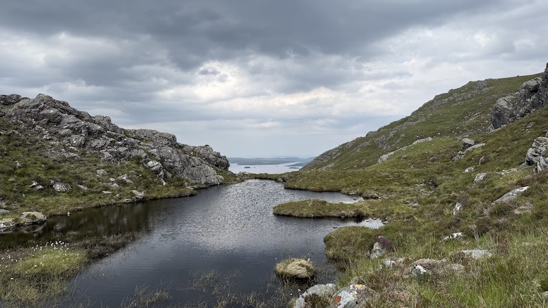
The next 2.5km of hiking was much more benign although I still needed to avoid plenty of crags ands rocks. This is a very rugged landscape and I needed to keep a close eye on the map. Each time, just when I thought the terrain had eased, I came across another steep drop.
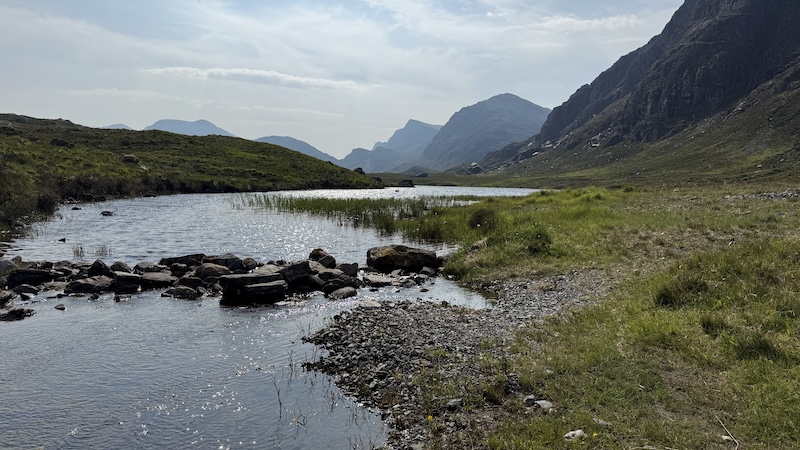
Eventually I could see the glen path below me and after another short section of rough moorland, I was back to easier route finding. By now, the heat had built up in the lower glen and it felt very warm indeed. I had drunk far more water than I usually do and it was fortunate I could fill up my water bottles with fresh water as I passed by various burns.
I turned left and simply jogged along the fairly flat path back towards where we had left the bikes.
I passed below the base of a corrie where David had pointed out a steep descent earlier in the day. I couldn’t see him anywhere although I did think to myself that the drop looked steeper than before.
Then, just ahead of me on the path, I spotted David jogging along. He had been faster than me while also taking in the third mountain and the second Corbett. I caught up with him as he stopped to chat to a cyclist who had a tyre puncture. Sadly, the man was facing a long walk back along the glen and while we offered to help, he said there wasn’t much to be done.
- 20km run-hike of Beinn Lair and Meall Mheinnidh : Strava and OS Maps
- David’s route: Beinn Lair, Meall Mheinnidh and Beinn Airigh Char: OS Maps.
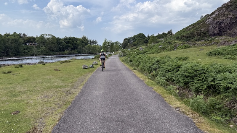
Return bike to Poolewe
The ride back down the glen was a delight. It was rough in parts and with a few short boggy sections, plus a burn to cross, but it felt like the easiest part of the day by far. Despite the need to follow Plan B, I was pleased that I had bagged two new summits and it was great that David had managed to complete the full route.
We were both hot and tired as we reached the car again – and we took advantage of a shop in Gairloch on the way home for a cold drink and an ice cream.