I am ticking off a list of Scottish mountains known as Corbetts. There are 222 Corbetts and they are between 2500ft and 3000ft tall. This walk took me to the most easterly Corbett, Mount Battock, via Glen Dye and Clachnaben.
Mount Battock walk from Glen Dye
There are not many Corbetts that have a well-defined path from start to finish. Most include a lot of off-the-beaten track tramping and, frequently, walkers are required to navigate a route for themselves. Mount Battock is a rarity because it has a track all the way to the summit.
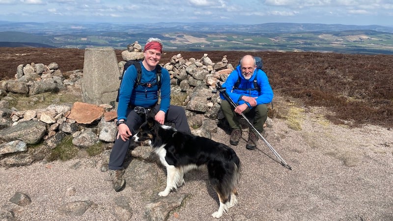
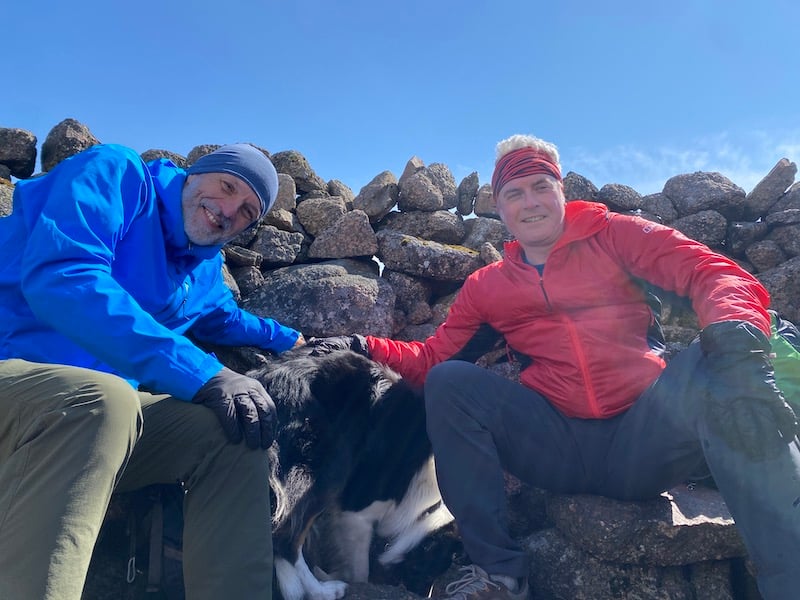
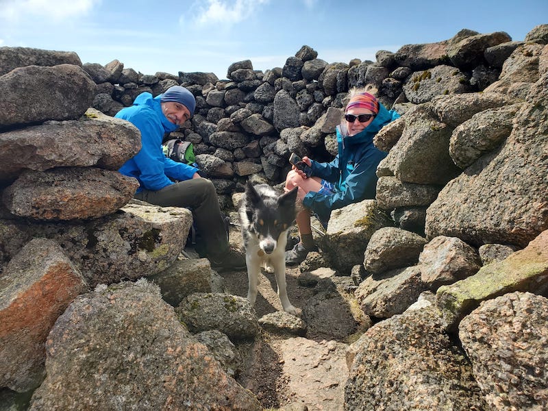
I usually walk Corbetts with my friend Ben or my friend Rob, but the other weekend they were both free and so we decided to walk as a trio. It was their first meeting and from the moment they met, they seemed to like each other and get on well. Rob’s collie Storm approved of Ben, too!
Between the three of us, we had a lot to chat about including our common interest of summit bagging. This includes Munros, Corbetts, Grahams (or Fionas!) and Donalds.
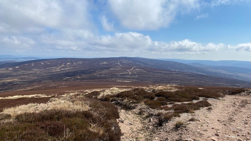
It turned out that having plenty of conversation is useful when walking the track to Mount Battock summit because it’s a long way and apart from the lovely views there is little else to distract.
First, though, the summit of Clachnaben
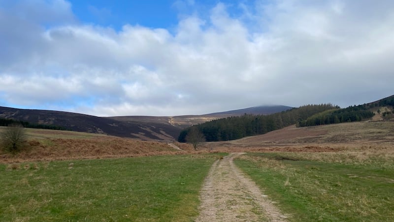
Our walk started at a small car park in an old quarry just north of the settlement of Bridge of Dye, in Aberdeenshire. A path led us downhill at first and through peaceful woodland with a mix of trees, including Scots pines, Douglas firs and larches.
The route levelled as we reached the base of the glen, where we crossed a bridge and headed right at a junction on a track into an open grassy area known as Miller’s Bog. The air was still and when the sun shone, it felt delightfully warm.
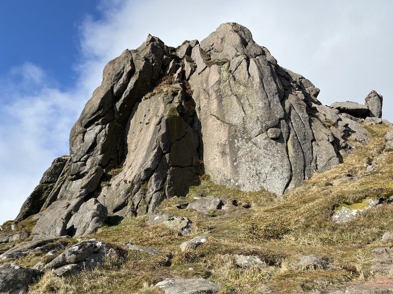
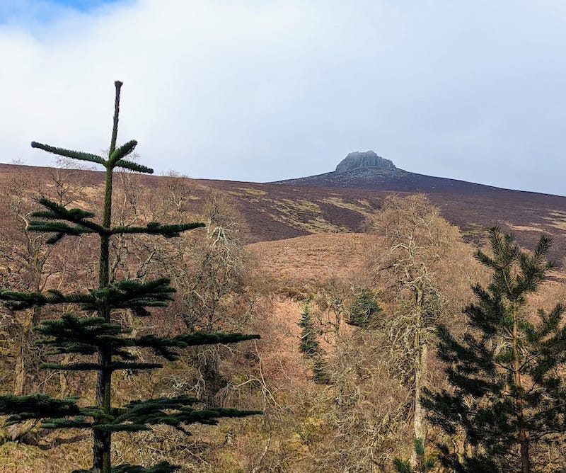
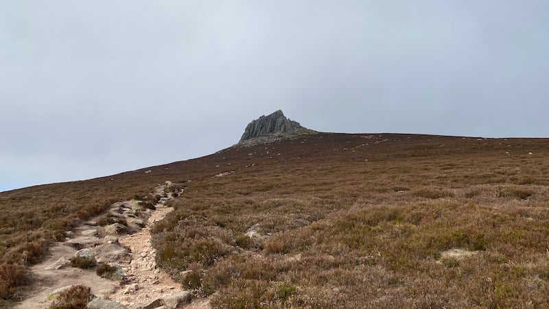
It was here that we first glimpsed the great tor that sits atop Clachnaben up ahead. The view of the huge rocky outcrop is all at once dramatically breath-taking. Looking like a vast ruined fortress or the darkened outline of enchanted castle, the jagged lump of granite rises steeply from close to the summit above Glen Dye.
It’s a skyline sight that was stunning enough to halt our non-stop chat and we stood stock still to gaze upwards.
Folklore and fact of Clachnaben
It’s not difficult to see why the existence of the giant outcrop has become the stuff of folklore legend. One fanciful story tells of two rival giants who are said to have been fond of throwing rocks at each other. The giants, Jock o’ Bennachie and Jock o’ North, who lived on different local hills, hurled a large boulder that landed on Clachnaben and that became the tor.
In another tale, the tor is called “the devil’s bite” because it was believed that when the devil took a bite out of the hillside, he found it to be too sour and spat it on to Clachnaben summit.
In fact, the tor is the result of natural erosion and weathering of rock, but even up close it looks otherworldly.
The word Clachnaben derives from the Gaelic, “Clach na Beinne”, which means the Stone on the Hill.
Walking onwards, Rob, ben and I wandered into the outer edge of another woodland. This time, the trees were tall pines and the path followed alongside a fast-flowing stream.
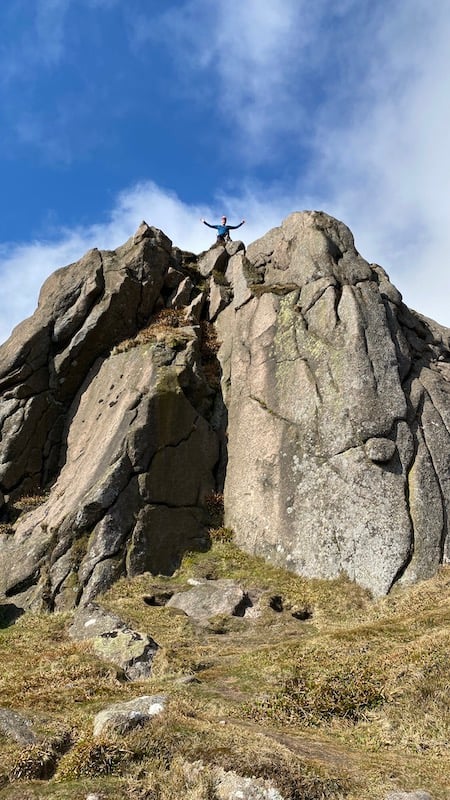
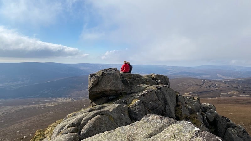
Past the plantation, the route turned left and we began the climb on Clachnaben. Granite steps aided the ascent in places although the path is steep at times and we had short rests to catch our breath and view the tor as it loomed ever bigger above us.
Up close, the granite has a mottled brown-grey hue and the rocks feature huge folds and creases. Steep sides guard one side of the tor and so we followed a rough path to the right and around the back of the rocks.
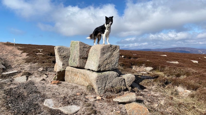
It’s a short and relatively easy scramble to climb to the top of the tor at 1932ft (588m) elevation, where we stood and surveyed the fabulous wide views of the wider rolling landscape, including the hills of Oxen Craig, Mither Tap and Bennachie. We could also see the Munro of Lochnagar.
Just below, to the north-west, a trig marked a height of 1899ft (578m) and stretching further west was a line of summits, including Hill of Edendocher, Sandy Hill and Hill of Badymicks, that undulate towards a high point of 2552ft (778m) on Mount Battock.
Walking on to Mount Battock
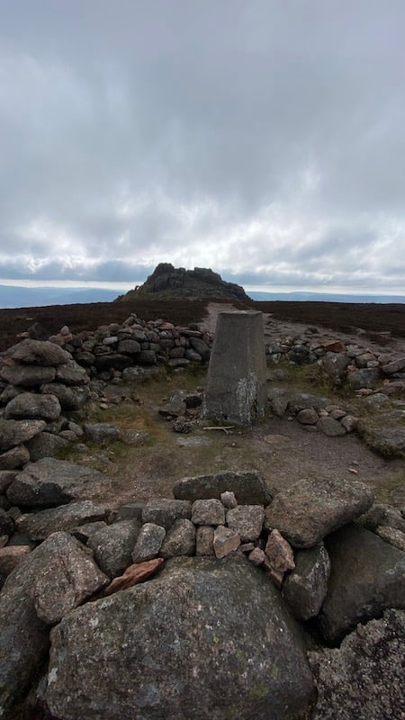
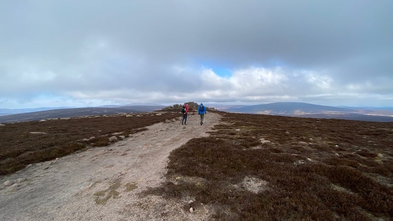
Our destination was the summit of Mount Battock and after enjoying the views from Clachnaben, we headed towards the trig pillar and then continued on the very defined and wide track.
The route undulates and steadily climbs over smaller hills – the Hill of Edendocher and the Hill of Badymicks – before a final push for the summit of the Mount. The last section is steeper, although not as steep as many other mountains in Scotland.
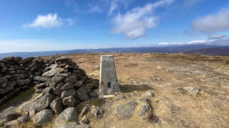
A summit trig pillar sits beside a large double windshelter of stones.
Thanks to good weather – sunny but cold – we could see for many miles around. The landscape in southern Aberdeenshire is of rolling hills and mountains and we could spot the Munros of Driesh and Mayar, as well as Mount Keen, the most easterly of the Munros.
The return route is to follow the path and track back the way you came.
It would be possible to cycle this route on a mountain bike, but we all agreed that it is a great walk in good company and on a day of fine weather.
Mount Battock walk details
Start/finish: Clachnaben Quarry car park just north of the Bridge of Dye
Distance: 25.5km
Total ascent: 1075m
Corbetts bagged: 117
There is an alternative shorter route from Glen Esk.