Clisham (An Cliseam) is the only Corbett on the Isle of Harris and the summit at 799m elevation is also the highest point in the Western Isles.
I had been hoping to do a circuit known as the Clisham Horseshoe, but the weather wasn’t promising and so my friend Lynsey and I chose to walk the more direct return route.
This had the advantage of being a shorter distance, too, which meant we could complete the walk in between disembarking the ferry from Ullapool to Stornoway in the early afternoon and reaching our evening accommodation before sunset.
The total distance is just shy of 6km and a total ascent of close to 650m. Our moving time was around two hours.


Direct route of Clisham
We started at a small parking area on the side of the A859. A trod left the gravel area heading north-west, right next to a stream, and it soon became apparent we would be walking through a lot of wet and bog.
We followed the line of the burn for around 1.5km, before tracking a little more westerly and on to slightly drier ground. As soon as we reached the start of the hill slope the gradient steepened and it didn’t really let up until we reached the top.
It wasn’t “steep, steep” but there was little relief for the leg muscles from base to summit.
The trod came and went and, for some the ascent, we detoured off the route. However, the main aim was to to avoid areas of steeper crags higher up the mountain, which was easy to do because we could see the way ahead. You’ll need some careful navigation if it’s very claggy.
Mud and bog eventually gave way to a terrain of grass strewn with rocks. The path also became more obvious at higher altitude although we then found ourselves walking into mist.
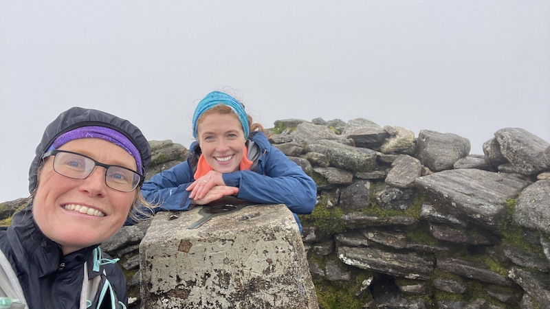
I am sure the views are superb on Clisham – but sadly our vista was only thick cloud. When booking a trip to the Scottish islands, you always take a chance on the weather and this time we were not so lucky.
Even so, we enjoyed the exertion of the climb and the huge stone shelter that surrounds the trig pillar on Clisham is well worth a visit.
Lynsey and I stopped for a quick bite to eat, enjoying the break from the strengthening wind.

Return route on Clisham
We returned a similar route, although we stayed closer to the course of the stream and a little further north. It is sometimes easier to stick to a trod on the descent, compared the ascent.
Although now facing into the wind, the descent was fairly fast, despite the wet and mud underfoot. We both slipped to our bums several times, laughing at each other’s accidental falls. Thankfully none of the slips were painful, they were simply wet and boggy!
I plan to return to this Corbett when the weather is better so I can complete the full circuit.

Details: Clisham
Distance: 5.8km
Total ascent: 646m