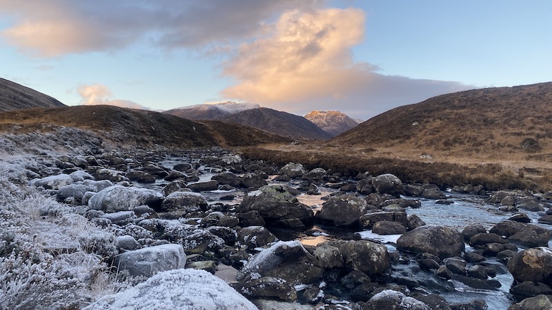
Am Faochagach is a remote-feeling Munro located amid a huge moorlands area north of Loch Glascarnoch in Wester Ross. It’s known for being a boggy outing and there is also a river crossing early on that can be tricky after a period of heavy rain. To mitigate some of the worst of the soggy bog, I chose a winter’s day when temperatures were low enough to freeze the ground. My friends Rachel and David came, too.


Looking back to 2020
I last walked Am Faochagach in the summer of 2020. I was closing in on the last 20 or so Munros of my first round and Hubby G and I hiked the out-and-back route on a fairly sunny day. We faced some boggy moorland but it wasn’t as bad as we had feared and I expect this was due to a period of dry weather.
I remembered there seemed to be numerous false summits – false hopes! – on the mountain but it was also a walk at the end of a week of focused Munro bagging and we were both tired.


Winter’s hike: Am Faochagach
Rachel, David and I left the car on the side of the A835, at Torrandhu bridge. After crossing the road, we headed straight on to the rough moorland, albeit on a path. Ice had formed where water had collected on the path and we needed to take care not to slip. This meant we mostly walked at the edge of the trod.
Our route took us north to reach a river that flows from Loch Gharbhrain. There is no easy way to cross the river and due to icy rocks and fairly high water we spent time trying to find an “easier” place to get across. Eventually, Rachel suggested we take off our boots and socks and paddle the river so as to ensure we would have dry socks and boots for the rest of the walk.
David, who was wearing sturdier winter hiking boots, decided to walk through the water and on some rocks and he was fortunate to keep his feet dry. Rachel and I, wearing less substantial boots, opted for the bare foot idea.
The water was icy, icy cold and half way through the paddle I thought my head would explode with the pain from my feet. The stones and rocks at the base of the river made the crossing slower.
It was with huge relief that I made it to the northern bank of the river but it took a lot more time for my feet to thaw. The pain as the blood returned was excruciating. Rachel appeared to suffer in a similar way. However, we did have dry feet and when the circulation returned, they stayed warm for the rest of the day.
Suffice to say, we kept our boots on for the crossing on the return leg when we were able to take more of a chance with a slip and wet feet.
Climbing to the summit ridge
The rest of the walk was uneventful and we followed the edge of a path for most of the way. The sun was out for much of the walk and while it was cold in the wind, we felt fortunate to be in such a beautiful winter’s landscape on a Sunday in December.
All around, the mountains were capped with snow and as we walked Am Faochagach, we enjoyed fantastic vistas.
We walked upwards towards a bealach, passing many small waterfalls in the stream. From the bealach, the route goes north along a gentle ridge.
While normally grass covered, we tramped through snow that was deep in places. Walking on snow is a bit like walking on sand and you are never quite sure where your foot will disappear or stay steady.
Just as I recalled, there was a series of summits with the first one rising to around 840m.


The views over Beinn Dearg, the Fannichs and the Fisherfields were superb, especially as they were snow-capped. Looking south, we could see our “local” Munro, Ben Wyvis, in the distance.
After the high point, the terrain descended a little and then called for us to climb again. The top of Am Faochagach is 954m elevation and we enjoyed more superb views, including iconic Suilven on the west coast.


Return on Am Faochagach
To return, we followed almost the same route, except we crossed the river at a different point and took our chances with ice-covered rocks and icy river water. Surprisingly, we all made it across with our feet dry.
The descent was a little trickier on the icy ground because going downhill always provides greater potential for slipping on wet, muddy of icy terrain. I took a fall at one point but thankfully landed safely.
We had not set off until later in the day, so our five-hour walk took us close to sunset. As we completed the route, the sun disappeared behind the mountains and we felt the cold of the evening seeping across the landscape. We were happy to once again reach the A835 and my vehicle before the hour’s drive back to Inverness.
It had proved to be an excellent day out hiking with good friends.

Route details: Am Faochagach
Distance: 15km
Total elevation: 800m

