
My previous adventure to bag the three Munros Sgurr a’ Chaorachain, Sgurr Choinnich and Maoile Lunndaidh in the Highlands area of Glen Carron was in 2021. It was a hot day and Hubby G and I cycled the first 5km along a track from Craig.


More recently, I completed the same route but added in a couple of Munro Tops and did not use a bike. My friend Cath insisted that we should do the whole route on foot because she was keen to use the outing for training for the Skye Ultra race. Victoria and I were happy to oblige, although we did all find the final 10km run back along the glen quite testing.
As well as the three Munros, I wanted to add a couple of Munro Tops. While one Munro Top, Carn nam Fiaclan, is part of the Munro route, the other MT, Bidean an Eoin Deirg, required a bit of a detour. Cath and Victoria were happy to indulge my new goal of bagging MTs.


Run-hike to Sgurr Choinnich
There is a small car park just off the main road at Craig, on the north side of the A890. The route starts by crossing the main road, then a railway line to join a wide track that wends its way south. The three of us treated the first five kilometres as a warm up, running the flats and briskly walking the ups. This section rose from an elevation of around 75m to 275m.
While the track continued east along the glen, we diverted south on to a smaller path and then crossed a river on a wire bridge.
From here, a track climbed steeply uphill, offering a few zig-zaps to slightly lessen the gradient. Following the side of Allt Leathad an Tobair, we ascended to reach Bealach Bhearnais at 596m elevation, before another rise and then a sharp turn to the east and then north east. It was easy to find our way because of a trod and fine weather.


Until this point, a gusty wind made the air feel very cold but then, as we hiked up the next steep rise towards Sgurr Choinnich we found ourselves suddenly shielded from the wind. From this point onwards, the conditions felt a lot more summery and we shed clothing layers to acclimatise.
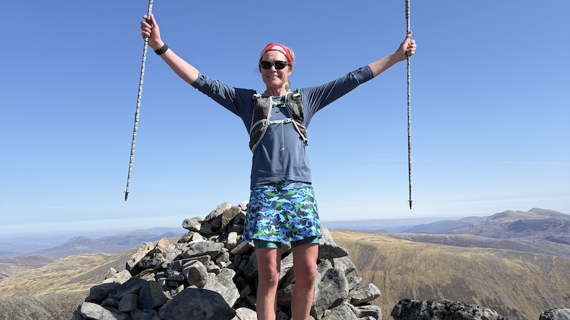
Again, there was an obvious route uphill and we stretched out in a line to suit our own paces. The summit of Sgurr Choinnich is at 999m and we stopped for a short while to have a bite to eat and to enjoy the superb views.

A quick jaunt to Munro 2
Sgurr a’ Chaorachain is the next Munro and while there was an obvious down and then another up, it seemed that we reached the 1053m top in no time at all. By now, we were relishing the warm conditions, although we had some worries about where we might be able to find fresh water. A look at the map revealed there should be water once we dropped down into the corrie and before ascending to Munro three.


Detour to a Munro Top
First though, there was a detour to a Munro Top. Bidean an Eoin Deirg sits along an easterly ridge and rises to 1047m. I asked Cath and Victoria if they wanted to bother with this extra section but seemed as keen as me.
The weather was great, the views were superb and we were all happy to be moving well on easy-going ground.
A light trod in spongy moss showed the route to the Munro Top and it proved ot be an easy out-and-back run to bag Bidean an Eoin Deirg.
Having returned to Sgurr a’ Chaorachain, we then tracked north and steeply downhill into Coire an Lochain Ghaineamhaich. We headed around the northern shore of the loch and this is where we found a lovely bubbling burn to refill our water bottles.
It was fantastic to drink the fresh, cold water and sit for a while to eat more food. We could see our third Munro rising to the east and we knew there was going to be a long ascent to Maoile Lunndaidh.

MT2 and Munro 3
We had estimated the overall distance for the route to be around 30km and we knew the final Munro would be done on tiring legs. At first, we crossed rough moorland before we started to gain height again. Some 3km on and we reached Carn nam Fiaclan, which qualifies as a Munro Top at 993m elevation. Only a short way on, we reached the third Munro, Maoile Lunndaidh at 1005m.


Final descent and glen run
The descent from Maoile Lunndaidh was the toughest part of the route for me. It seemed never-ending and on rough ground. We could finally see the track lower in the glen but it never seemed to come any closer.
Eventually we reached the lower flanks of the Munro and followed sections of trod through boggy ground to gain the track.
We joined the wide track east of Glenuiag Lodge. There is also a wee shelter close to the lodge. From here the aim was to run or brisk walk back to the roadside. Looking at the map, there was around 5km to reach the point where we left the track earlier in the day – and then the final 5km to the car park. I had no idea as I set off that I would run it all but, in the end, I did. My running pace is different from Cath and Victoria and I knew they would be happy for me to progress as I wished. I just set myself a comfortable pace and enjoyed the gentle descent.
The low sun felt fierce and I kept drinking water from my soft flask as I ran. It was a relief to reach the railway and the the road again. While I waited for Cath and Victoria, I enjoyed a chat with a thru-hiker who was walking the Cape Wrath Trail.
It turned out that my friends had stopped to help a man who had fallen from his mountain bike but, even so, they were not far behind.

This is a great route that came closer to 36km distance and included just over 2000m of ascent.