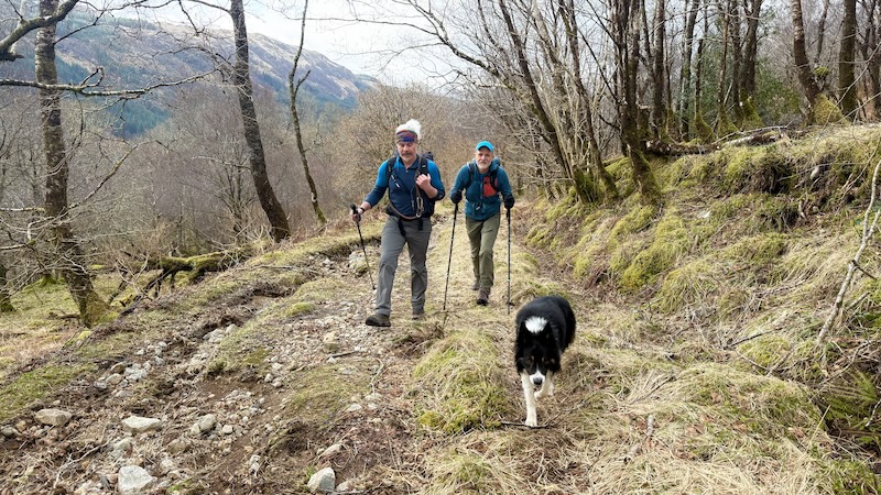
The Ardgour peninsula in west Scotland is a favourite destination and on this occasion I walked with my friends Ben and Rob and Rob’s collie Storm. On Saturday, we completed an A-to-B traverse of one of the tallest Fionas, Sgurr a’ Chaorainn, as well as one of the smallest Corbetts, Beinn na h-Uamha. The route extended to almost 22km and included just more than 1350m of ascent.
To qualify as a Fiona, or a an “old Graham, the summit must be between 2000ft and 2500ft (609.6m to 762m). A Corbett is listed as between 2500ft and 3000ft tall (762m to 914.4m). In both definitions, the drop on all sides of the mountain should be 150m or more.
During our Ardgour hike, we reached the 761m summit of the Fiona, Sgurr a’ Chaorainn, and the Corbett, Beinn na h-Uamha, at just a metre taller at 762m.
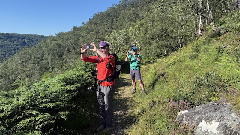
In contrast to a previous Corbett bagging outing of Sgùrr Dhomhnuill in July last year, the weather was a great deal cooler. The landscape was also duller than the summer lush greens under a bright blue sky. But the rewards for our adventure were still great.
Where is Ardgour?
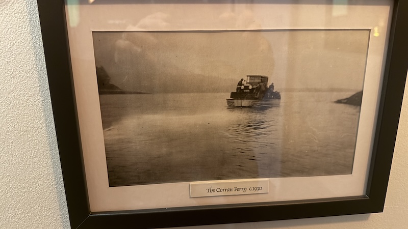
Ardour is located across Loch Linnhe from Fort William. Most people take the Corran Ferry, just south the town. The small vehicle and passenger crossing takes about five minutes. It costs £12 each way if you have a car or van.
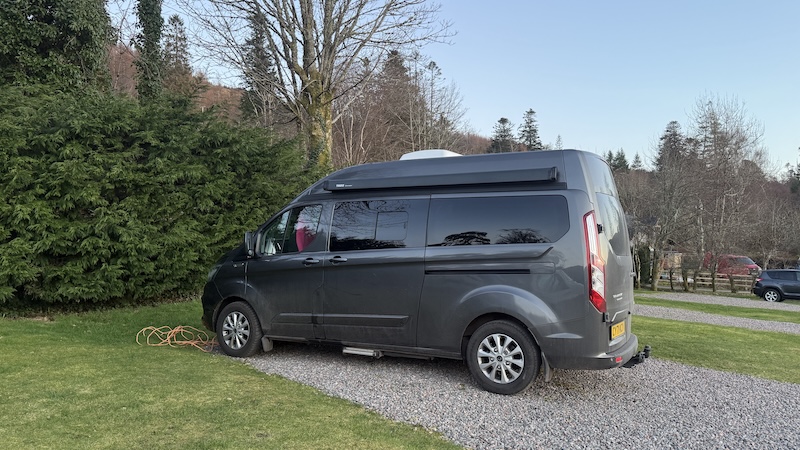
Rob and I stayed in our campervans at Sunart Camping, Stronian, while Ben booked a cabin. We ate at the Strontian Hotel both Friday and Saturday evening. The food and service were really good.
Traverse of Sgurr a’ Chaorainn and Corbett Beinn na h-Uamha
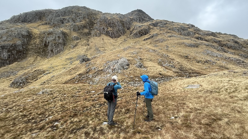
Having left a car at the end of the route, we drove to the start and parked (£3 for the day) at Ariundle Oakwoods. The forecast had promised sunshine but it was more of a hit-and-miss type day with some sunshine and also plenty of cloud and strong winds at higher elevation. We were grateful for our rucksacks of winter layers, plus gloves and hats.
We joined a wide track through the woods, which are a remnant of the native oakwoods that once extended along the west coast of Scotland. These are now designated a National Nature Reserve.
In contrast to the lush green foliage of the trees in summer, our latest walk was before springtime in Scotland and the trees were mostly bare. A number of storm felled trees criss-crossed our path, heading north-east, and the verges were also showing signs of a tough winter. However, it was interesting to see what is beneath the foliage, including lichen, moss and fungi.
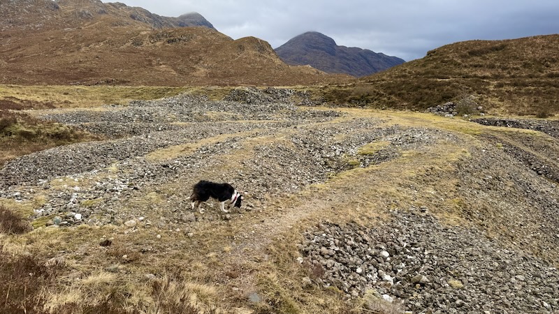
After around 5km, we reached an old lead mine. All that is left of the Strontian mine is some spoils and workings but it’s very obviously a man-made landscape. We walked across these and then on to a much fainter path.
At first, we considered traversing the side of the mountains ahead to reach a bealach just before our first summit but the going quickly became tough on a ground thick with vegetation. So, on second thoughts, we rejoined the faint path that heads higher over the rocky ridge. This meant we had more ascent and descent overall but it made for easier navigation.
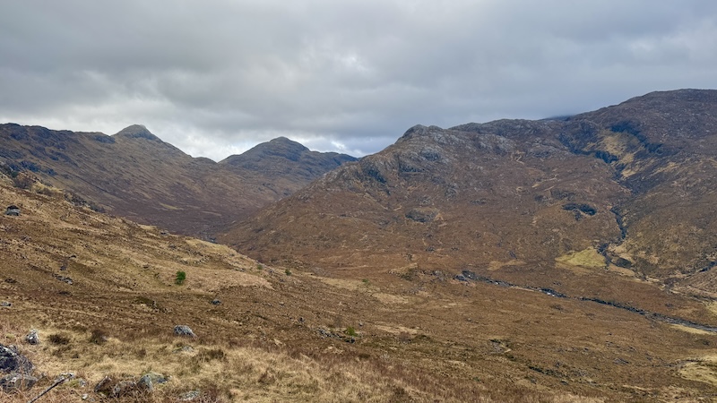
The route was similar to the one we followed last summer for Sgùrr Dhomhnuill. At the point where we turned left to climb towards the summit of Sgùrr Dhomhnuill, we met a small group of people from Inverness Mountaineering Club. Their aim was Dhomhnuill, while we carried on in south-easterly direction towards Bealach Mam a’ Bhearna at around 490m elevation.
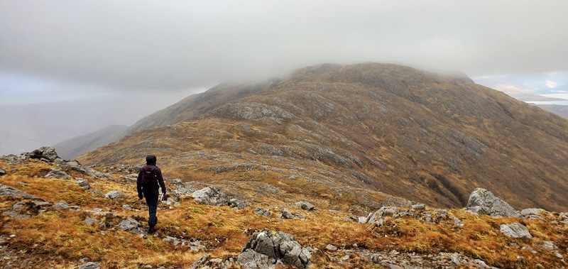
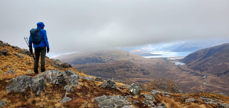
The walk to reach the summit of the Fiona took some three hours from the start and involved plenty of ups and downs. For the final climb we zig-zagged up a rocky mountain slope and felt the force of some strong gusts of winds.
It was disappointing to find ourselves in cloud at higher elevation but I still enjoyed the challenge. It was the first major mountain hike of the year for all of us and while we felt this in our legs, it was good to be stretching ourselves.
As we walked, we chatted and laughed and made the most of the many hours for a catch up. I have known Rob for some 15 years and I went to school with Ben, but they only met in the last few years. We all get along very well.
Sgurr a’ Chaorainn to Beinn na h-Uamha
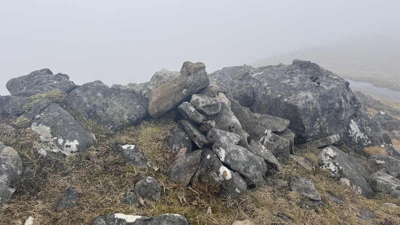
We didn’t hang around on the windy and cloud summit of Sgurr a’ Chaorainn but decided to find a more sheltered place for a quick break and a bite to eat.
We also checked the map before heading off the summit. The route required a change of direction and we didn’t want to make a mistake.
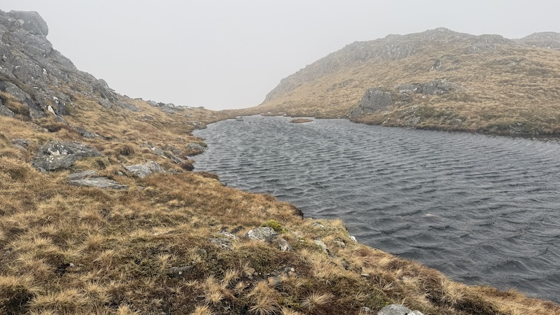
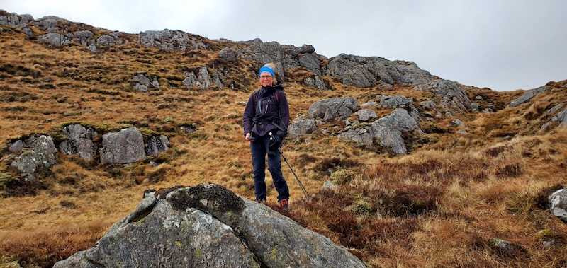
The next section included more ups and downs and through a rugged terrain. There were no path to follow so it was important to keep an eye navigation.
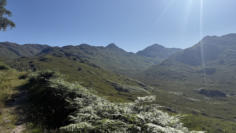
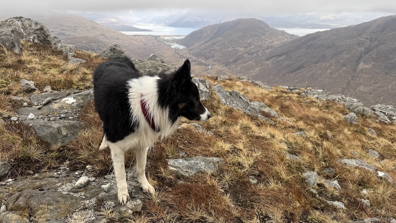
The clouds came and went offering some superb glimpses of far-stretching vistas. In fine weather, you can see numerous peaks in all directions, as well as a long west coast and many lochs.
Wildlife was not abundant on the mountain, although we were fortunate to be treated to the sightings of three eagles overhead.
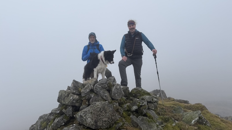
Again, the summit of Beinn na h-Uamha was too breezy for a sit-down so we sought out a large rock to sit behind for another snack.
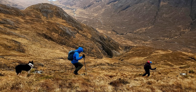
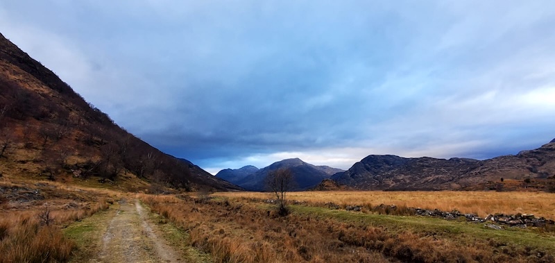
We knew from the map that the descent towards Glen Gour would be steep. We traversed along the ridge for a while before choosing a slope that looked just about manageable. Our technique was to take short zig-zags downhill to reduce the severity of the decline.
This part of the hike seemed to take a long time and when we looked ahead, east along the glen, the end point appeared to be a very long way away.
We kept our up-beat chatter going and enjoyed the improving weather conditions. The clouds had started to lift and we could feel some warmth from the sun.
Finally reaching the glen, we needed to cross a river. This was a lot easier than we had feared and after tramping over another stretch of vegetation-thick ground, we finally reached a track.
The last 6km of the day’s hike followed the track, which was mostly a surface of mud, stones and puddles, as well as some sections of wonderfully easy-going short grass.
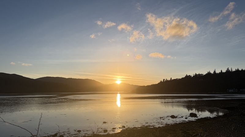
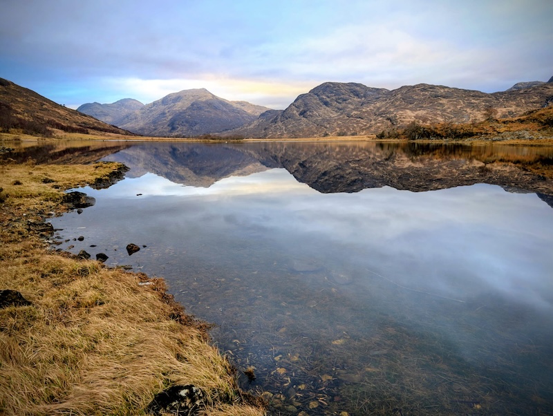
Towards the end of our hike, we walked alongside a gorgeous loch. A solo swan bobbed in the distance and we enjoyed a beautiful early evening light over distant snow-topped mountains.
We all agreed that an A-to-B route is very satisfying. In retrospect, it was a much better idea to do the route at this time of the year because in the summer the vegetation will be taller and thicker.
Route details: Sgurr a’ Chaorainn to Beinn na h-Uamha
Distance: 22km
Total ascent: 1350m
Corbetts bagged: 175
Fionas bagged: 55
- Thanks to Rob and Ben for some of the photos.