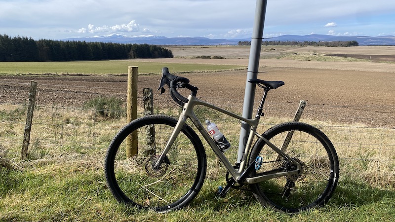
The Black Isle is a small peninsula north of Inverness and the place I have called home for almost three years. I have explored on foot – both running and hiking – and also by bike. The gently undulating landscape with many quiet roads and forest tracks, plus superb coastal views, is ideal for cycling.
I chose my gravel bike for good versatility so I could ride on tarmac and trails. Many of the quieter roads have smooth tarmac but, like so many places in the UK, the surface has deteriorated in places and this makes a gravel bike a good choice, even when road cycling.
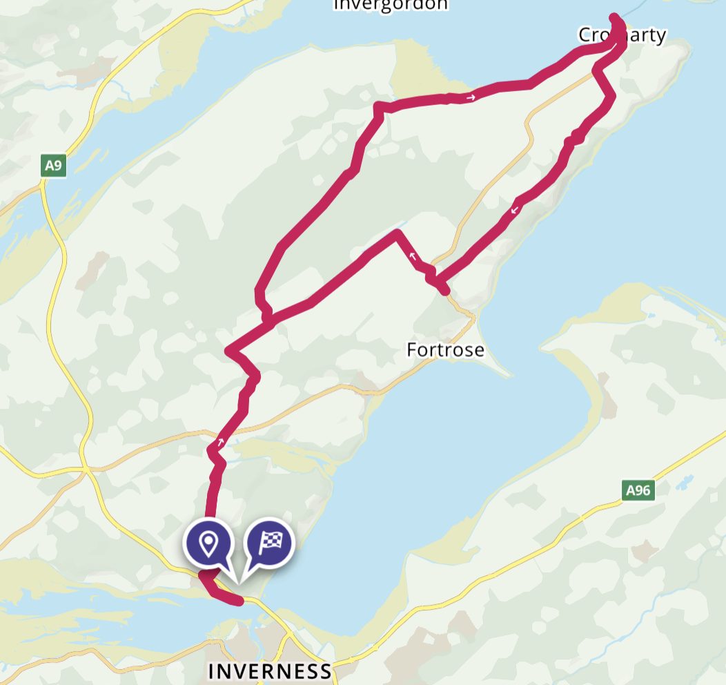
Black Isle cycle loop
This route can be started from a number of different places, such as Inverness, North Kessock, Munlochy, Avoch, Fortose or Cromarty.
It is around 65km to 70km depending on your start point. Add another 5km if you start from Inverness. It makes use of Sustrans Route 1, as well as other mostly quiet, singletrack roads and some forest tracks.
I began the route from my home village, while the OS Map detailed below starts and finishes in North Kessock. There is a pay and display car park on the shore, opposite North Kessock Hotel.
North Kessock to Cromarty
From North Kessock, you climb uphill, head under the A9 (there is an underpass for cyclists ) and then cycle through the small settlement of Drumsmittal.
The road takes you to Munlochy, before crossing a busier road and heading uphill again towards Killen. This is where you join Route 1 and you will see signposts at the side of the road.
After turning right towards Killen, north of Munlochy, I cycled around 2km and then took a smaller road north towards Wester Strath. This climbed gently uphill and, at the farm, the road turned into track. There is a gate but you can ride around it.
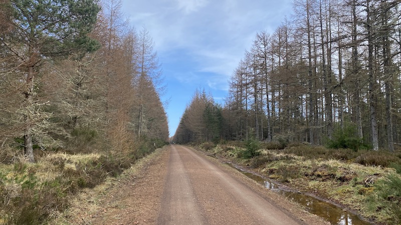
I followed a generally north-easterly direction on a wide track in Millbuie Forest. It was easily manageable on my gravel bike. It would be fine for a hybrid bike, too.
I finally came out of the forest at Mounthigh, still cycling north-east until a road sign told me Cromarty was to my east and some 6 miles (10km) along the coast.
I had been warm until this point but a cool wind forced me to put on my jacket and winter cycling gloves again.
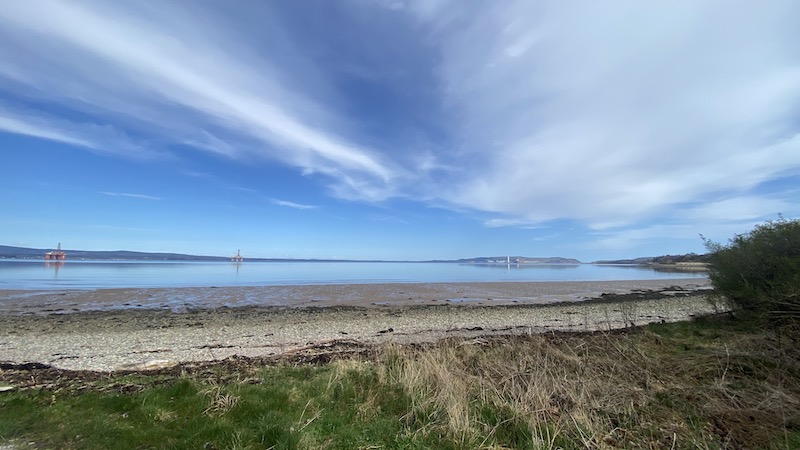
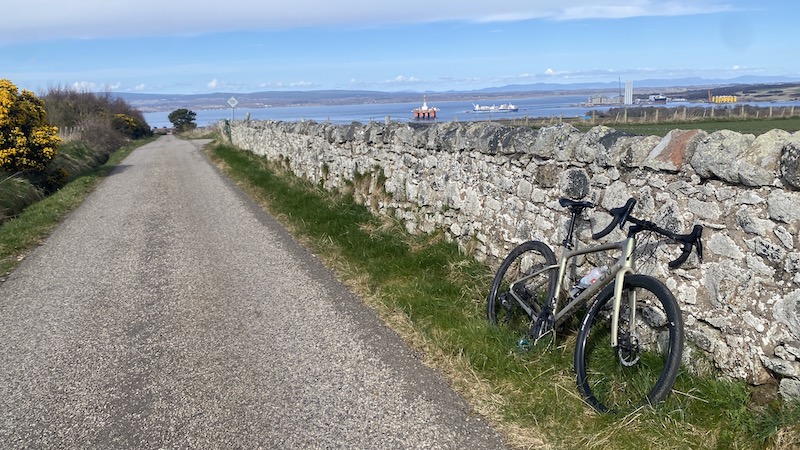
The B9163 travels through Jemimaville and along an attractive coastline of the Black Isle. A number of oil rigs sit in the Cromarty Firth. I find them strangely attractive. The juxtaposition of industry and nature isn’t as ugly as I had always imagined it might be. There is a background hum from the rigs but not enough to drown the sound of seabirds.
I stopped at a small gravel car park to take in the view and witnessed a beautiful heron as well as other birds. There is a RSPB hide at Udale Bay near Jemimaville.
The historic arts village of Cromarty was around half way on my cycle route and I stopped at Slaughterhouse cafe for a coffee and cake. Note, on busy days you will need to wait around half an hour for a coffee. There is also Sutor Creek as an option for lunch or a snack.
From Cromarty – the second half
It’s a good idea to refuel for the next stage of the cycle route. I cycled south-west out of Cromarty on a busier road – the A832 – before turning south after 2km at a sign for Navity and Eathie. The road from here is very quiet.
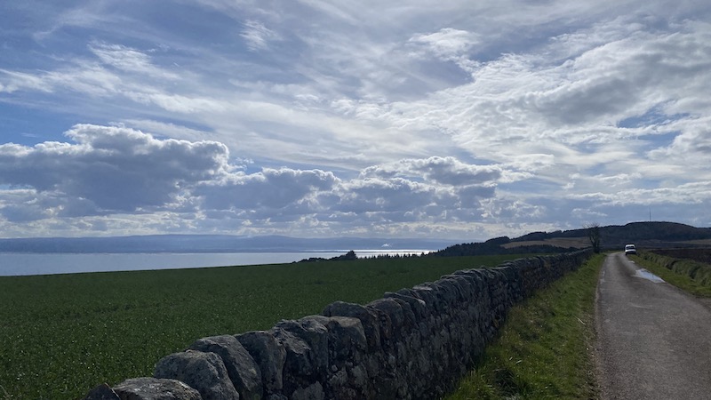
This is a section that includes the most sustained uphill effort but the views provide great rewards. You leave behind a wide vista of the Cromarty Firth before being faced by another stunning sea view of the Moray Firth to the south. I looked ahead on the road and could see phone mast above me. The road climbs through a serious of different gradients to reach the mast at 218m above sea level. Looking to my right I could see snow-capped mountains in the distance, including Ben Wyvis.
After this, the road travels mostly downhill, passing Learnie Red Rocks MTB centre and often with lovely sea views. The spit of land at Chanonry Point, near Fortrose, can be seen in the distance, as well as Fort George on the opposite southern bank of the Moray Firth.
When the road reaches the busier A832, turn right and cycle uphill again. This felt like a challenge after so much lovely downhill, especially when I took another turn on to the B9160 and saw more ascent.
At Upper Raddery, turn left (signposted for Killen). This is Route 1 again and the road is straight and mostly downhill. I enjoyed a tailwind and felt like I was sailing along on my bike.
There are various options to turn left for Fortrose or Avoch (pronounced Och) but I kept going and eventually rejoined my outward route. To reach the start/finish, the route was mostly downhill, although with a few short sections of uphill thrown in.
The overall route is pleasantly meandering and undulating with fabulous views.
Route details:
Start/Finish: North Kessock
Distance: 68km
Total ascent: 850m.
See “Black Isle Meander” on Strava and OS Maps. This is a suggestion for a route because you will see on the map there are plenty of other options for shorter or longer bike rides.
Overview of Sustrans Route 1
Sustrans Route 1 travels the length of England (starting at Dover) and Scotland, crossing the border on the east coast just north of Berwick-upon-Tweed.
The National Cycleway heads west through Scottish Borders towns and villages. It turns north at Innerleithen, journeying to Edinburgh, before again heading west. Once over the Firth of Forth via The Forth Road Bridge, Route 1 reaches Fife and continues north into Dunfermline before heading east to reach St Andrews on the coast.
The cycleway meanders north long the coast of Fife and into Angus – check out my Angus coast end-to-end trip – then to Aberdeenshire. The route turns west again along the northern shoreline of Aberdeenshire, progressing into Moray before heading south from the seaside town of Nairn.
Route 1 takes cyclists into the Highlands city of Inverness and then on to the Black Isle. There are two options for Route 1, to head north on the Black Isle and make use of summer only ferry across the Cromarty Firth. At other times of the year, cyclists need to travel via Dingwall and then to Alness.
The route rejoins on the southern shore of the Dornoch Firth and pushes on further north through Sutherland to finally arrive at John o’ Groats, where it finishes.
You can also access Route 1 at Inverness by cycling from the south on Route 7. See my article about cycling from Aviemore to Inverness.